Weston Mills

Weston Mills
Weston Mills
Lugar designado por el censo de los Estados Unidos
Weston Mills
Weston Mills
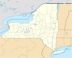
Ubicación en el condado de Cattaraugus y en el estado de Nueva York
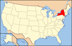
Map of USA NY.svg
Ubicación de Nueva York en EE. UU.
42°4′13″N 78°22′44″O / 42.07028, -78.37889Coordenadas: 42°4′13″N 78°22′44″O / 42.07028, -78.37889
Entidad Lugar designado por el censo
 • País Bandera de los Estados Unidos Estados Unidos
 • Estado Flag of New York.svg Nueva York
 • Condado Cattaraugus
Superficie  
 • Total 17,5 km²
 • Tierra 17,2 km²
 • Agua (1,33%) 0,3 km²
Altitud  
 • Media 89 msnm
Población (2000)  
 • Total 1.608 hab.
 • Densidad 93 hab/km²
Huso horario Este: UTC-5
 • en verano UTC-4
Código ZIP 14788
Código de área 716

Weston Mills es un lugar designado por el censo ubicado en el condado de Cattaraugus en el estado estadounidense de Nueva York. En el año 2000 tenía una población de 1,608 habitantes y una densidad poblacional de 93 personas por km².

Contenido

Geografía

Weston Mills se encuentra ubicado en las coordenadas 42°4′13″N 78°22′44″O / 42.07028, -78.37889.[1]

Demografía

Según la Oficina del Censo en 2000 los ingresos medios por hogar en la localidad eran de $34,706, y los ingresos medios por familia eran $40,978. Los hombres tenían unos ingresos medios de $37,688 frente a los $25,000 para las mujeres. La renta per cápita para la localidad era de $19,564. Alrededor del 5.1% de la población estaban por debajo del umbral de pobreza.[2]

Referencias

  1. «U.S. Gazetteer: Censo de 2010» (en inglés). Oficina del Censo de los Estados Unidos (16 de febrero de 2011). Consultado el 11 de julio de 2011.
  2. «American FactFinder» (en inglés). Oficina del Censo de los Estados Unidos. Consultado el 11 de julio de 2011.

Enlaces externos


Wikimedia foundation. 2010.

Игры ⚽ Поможем написать курсовую

Mira otros diccionarios:

  • Weston Mills — Weston Mills, NY U.S. Census Designated Place in New York Population (2000): 1608 Housing Units (2000): 694 Land area (2000): 6.657357 sq. miles (17.242475 sq. km) Water area (2000): 0.090519 sq. miles (0.234443 sq. km) Total area (2000):… …   StarDict's U.S. Gazetteer Places

  • Weston Mills, NY — U.S. Census Designated Place in New York Population (2000): 1608 Housing Units (2000): 694 Land area (2000): 6.657357 sq. miles (17.242475 sq. km) Water area (2000): 0.090519 sq. miles (0.234443 sq. km) Total area (2000): 6.747876 sq. miles… …   StarDict's U.S. Gazetteer Places

  • Weston Mills — Original name in latin Weston Mills Name in other language State code US Continent/City America/New York longitude 42.0759 latitude 78.37252 altitude 445 Population 1472 Date 2011 05 14 …   Cities with a population over 1000 database

  • Weston Mills, New York — Infobox Settlement official name = Weston Mills, New York settlement type = CDP nickname = motto = imagesize = image caption = image |pushpin pushpin label position = pushpin map caption =Location within the state of New York pushpin mapsize =… …   Wikipedia

  • Weston — NOTOC There are many places called Weston:People: For people named Weston, see Weston (surname). PlacesAustralia* Weston, Australian Capital Territory * Weston Park, Canberra * Weston, New South WalesBorneo (Sabah)* Weston, SabahCanada* Weston,… …   Wikipedia

  • Mills County, Iowa — Location in the state of Iowa …   Wikipedia

  • Weston, Hampshire — Infobox UK place country = England map type = Southampton static static image caption= Hampton, Havre, Oslo, Copenhagen and Rotterdam Towers (looking left to right) official name= Weston latitude = 50.8861 longitude = 1.3699 unitary england=… …   Wikipedia

  • Weston, Connecticut — Infobox Settlement official name = Weston, Connecticut settlement type = Town imagesize = image caption = The Onion Barn, where community bulletins are posted mapsize = 250px map caption = Location in Connecticut mapsize1 = map caption1 =… …   Wikipedia

  • Weston-on-Trent — infobox UK place country = England static static image caption=Weston Hall was built by Antony Roper latitude= 52.84 longitude= 1.40 official name= Weston on Trent map type= Derbyshire population = shire district= South Derbyshire shire county =… …   Wikipedia

  • Weston Road — For the portion of Weston Road in York Region, Ontario, see York Regional Road 56. A Weston Road sign in the former town of Weston, Ontario Weston Road is a north south street in west end Toronto, Ontario, Canada. The route is named for the… …   Wikipedia

Compartir el artículo y extractos

Link directo
Do a right-click on the link above
and select “Copy Link”