Weston and Weedon

Weston and Weedon
Weston and Weedon
Parroquia civil del Reino Unido
Weston and Weedon
Weston and Weedon
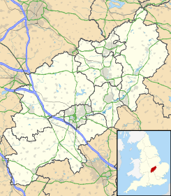
Ubicación en Northamptonshire.
52°7′1.329″N 1°7′51.0594″O / 52.11703583, -1.130849833Coordenadas: 52°7′1.329″N 1°7′51.0594″O / 52.11703583, -1.130849833
Entidad Parroquia civil
 • País Bandera del Reino Unido Reino Unido
 • Nación constitutiva Inglaterra
 • Región Midlands del Este
 • Condado Northamptonshire
 • Distrito South Northamptonshire
Población (2001)  
 • Total 330 hab.

Weston and Weedon es una parroquia civil del distrito de South Northamptonshire, en el condado de Northamptonshire (Inglaterra). Está formada por los pueblos de Weston y Weedon Lois.

Demografía

Según el censo de 2001,[1] Weston and Weedon tenía 330 habitantes (170 varones y 160 mujeres). 63 de ellos (19,09%) eran menores de 16 años, 244 (73,94%) tenían entre 16 y 74, y 23 (6,97%) eran mayores de 74. La media de edad era de 42,55 años. De los 267 habitantes de 16 o más años, 56 (20,97%) estaban solteros, 174 (65,17%) casados, y 37 (13,86%) divorciados o viudos. 162 habitantes eran económicamente activos, 155 de ellos (95,68%) empleados y otros 7 (4,32%) desempleados. Había 3 hogares sin ocupar y 135 con residentes.

Evolución demográfica de Weston and Weedon
1931 1941 1951 1961
328 - 323 294
(Fuente:Vision of Britain )

Referencias

  1. «Weston and Weedon» (en inglés). Office for National Statistics. Consultado el 12 de julio de 2011.

Wikimedia foundation. 2010.

Игры ⚽ Поможем написать курсовую

Mira otros diccionarios:

  • Weedon Lois — Pueblo del Reino Unido …   Wikipedia Español

  • Weston (Northamptonshire) — Weston Pueblo del Reino Unido …   Wikipedia Español

  • Weston, Northamptonshire — Infobox UK place official name= Weston country= England region= East Midlands population= os grid reference= SP589467 latitude= 52.1163 longitude= 1.1398 post town= postcode area= NN postcode district= NN12 dial code= constituency westminster=… …   Wikipedia

  • Weedon Lois — infobox UK place country = England official name= Weedon Lois latitude= 52.11781 longitude= 1.12391 population = unknown shire district= South Northamptonshire shire county= Northamptonshire region= East Midlands constituency westminster= unknown …   Wikipedia

  • List of abbeys and priories in England — Contents 1 Overview 1.1 Article layout 2 Abbreviations and key …   Wikipedia

  • Clipston and Oxendon railway station — Location of Clipston and Oxendon station on 1948 Ordnance Survey map showing location of the station south of Oxendon tunnel Clipston and Oxendon railway station on the Northampton and Market Harborough railway opened in 1863 as a result of… …   Wikipedia

  • Captain Scarlet and the Mysterons — This article is about the 1967 TV series. For the 2005 series, see Gerry Anderson s New Captain Scarlet. Captain Scarlet and the Mysterons …   Wikipedia

  • List of historic buildings and architects of the United Kingdom — The Historic buildings of the United Kingdom date from the stone age to the twenty first century AD, and tell the story of the architecture of the United Kingdom.See also: List of British architects Pre Historic buildings structures Roman… …   Wikipedia

  • List of civil parishes in Northamptonshire — This is a list of civil parishes in Northamptonshire, England. Most parishes have their own parish council, but some smaller parishes may have a parish meeting, or may join together to form a combined parish council. Some larger parishes have… …   Wikipedia

  • C.H. Middleton — Mr. Middleton portrait from his 1945 gardening guide Cecil Henry Middleton (22 February 1886–18 September 1945), widely known simply as Mr. Middleton ,[1] was a gardener, writer and one of the earliest radio broadcasters on gardening for the… …   Wikipedia

Compartir el artículo y extractos

Link directo
Do a right-click on the link above
and select “Copy Link”