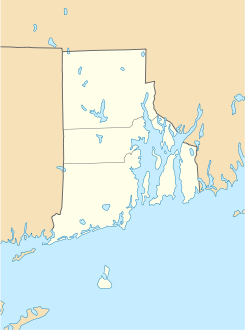
Wyoming (Rhode Island)

Wyoming (Rhode Island)
Wyoming
Área no incorporada de los Estados Unidos
Wyoming
Wyoming
Ubicación en el condado de Washington y en el estado de Rhode Island
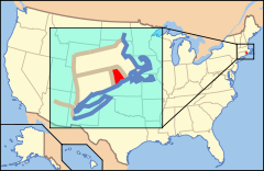
Map of USA RI.svg
Ubicación de Rhode Island en EE. UU.
41°30′57″N 71°42′12″O / 41.51583, -71.70333Coordenadas: 41°30′57″N 71°42′12″O / 41.51583, -71.70333
Entidad Área no incorporada
 • País Bandera de los Estados Unidos Estados Unidos
 • Estado Flag of Rhode Island.svg Rhode Island
 • Condado Washington
Huso horario Este: UTC-5
 • en verano UTC-4
Código postal 02898
Prefijo telefónico 401

Wyoming es un área no incorporada ubicada en el condado de Washington en el estado estadounidense de Rhode Island. Wyoming es un distrito historico agregado al Registro Nacional de Lugares Históricos el 2 de mayo de 1974.

Geografía

Wyoming se encuentra ubicado en las coordenadas 41°30′57″N 71°42′12″O / 41.51583, -71.70333Coordenadas: 41°30′57″N 71°42′12″O / 41.51583, -71.70333.[1]

Referencias

  1. «U.S. Gazetteer: Censo de 2010» (en inglés). Oficina del Censo de los Estados Unidos (16 de febrero de 2011). Consultado el 11 de julio de 2011.

Enlaces externos


Wikimedia foundation. 2010.

Игры ⚽ Нужно сделать НИР?

Mira otros diccionarios:

  • Rhode Island — (Details) …   Deutsch Wikipedia

  • Rhode Island Democratic Committee — Rhode Island Democratic Party Chairman Edwin R. Pacheco Senate leader M. Teresa Paiva Weed House leader Gordon D. Fox Ideology America …   Wikipedia

  • Rhode Island Red Monument — Rhode Island Red U.S. National Register of Historic Places …   Wikipedia

  • Rhode Island Constitution — Rhode Island s Royal Charter from 1662 The Constitution of the State of Rhode Island and Providence Plantations is a document describing the structure and function of the government of the U.S. State of Rhode Island. History The constitution was… …   Wikipedia

  • Rhode Island — This article is about the U.S. state of Rhode Island. For other uses, see Rhode Island (disambiguation). RI and R.I. redirect here. For other uses, see RI (disambiguation). State of Rhode Island and Providence Plantations …   Wikipedia

  • Rhode Island — 41° 42′ N 71° 30′ W / 41.7, 71.5 …   Wikipédia en Français

  • Rhode Island Route 3 — For the Route 3 that existed in the 1920s, see U.S. Route 6 in Rhode Island. RI 3 redirects here. RI 3 may also refer to Rhode Island s 3rd congressional district. Route 3 …   Wikipedia

  • Rhode Island Department of Children, Youth & Families — The Rhode Island Department of Children, Youth Families (DCYF) is a state agency of Rhode Island, headquartered in Downtown Providence.[1][2] The agency provides services for children and families The agency is responsible for the state s… …   Wikipedia

  • Rhode Island Route 112 — Infobox RI Route type= route=112 length mi=8.5 length km=13.7 formed=1923 dir1=South dir2=North from= to= previous type= previous route=110 next type= next route=113 Route 112 is a numbered State Highway running 8.5 miles in Rhode Island. It… …   Wikipedia

  • Kenyon (Rhode Island) — Richmond DEC …   Deutsch Wikipedia

Compartir el artículo y extractos

Link directo
Do a right-click on the link above
and select “Copy Link”