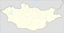
Öndörkhaan — In the Öndörkhaan Museum complex Öndörkhaan (Mongolian: Өндөрхаан; sometimes Undurkhaan), is a town in Mongolia located 290 km east of Ulaanbaatar. Öndörkhaan has a population of roughly 15,000 persons and serves as the capital of the… … Wikipedia
Khentii Province — Geobox|Province country = Mongolia name = Khentii Aimag other name = mn. Хэнтий аймаг coordinates type = adm1st lat d = 47 |lat m = 19 |lat NS = N long d = 110 |long m = 39 |long EW = E symbol type = Coat of arms symbol = Hentiy.gif established … Wikipedia
Lin Biao — Infobox President name = Lin Biao 林彪 imagesize = 100px caption = order = 2nd Executive Vice Premier of the People s Republic of China term start = 1965 term end = 1975 predecessor = Chen Yun successor = Deng Xiaoping birth date = December 5, 1907 … Wikipedia
List of cities in Mongolia — This is a list of cities in Mongolia … Wikipedia
Bor-Öndör, Khentii — Bor Öndör ( mn. Бор Өндөр), also written as Bor Undur, Bor Ondor, Bor Under, Boro Under, is a city ( mn. хот) in Khentii Province in eastern Mongolia. Bor Öndör is situated in Darkhan sum (district), but is administrated separately. Geography… … Wikipedia
Chandgana Tal — Changana Tal (Mongolian: Чандгана Тал) is a coal mine in the Mörön sum (district) of Khentii Province in eastern Mongolia. Geography Changana Tal mine is 25 km E from Mörön sum center and 53 km E from Khentii aimag capital Öndörkhaan.… … Wikipedia
Mongolia — This article is about the modern sovereign state. For other uses, see Mongolia (disambiguation). Mongolia … Wikipedia
Demographics of Mongolia — Demographics of Mongolia, Data of FAO, year 2005 ; Number of inhabitants in thousands. This article is about the demographic features of the population of Mongolia, including population density, ethnicity, education level, health of the… … Wikipedia
Ulan Bator — For the band, see Ulan Bator (band). Ulan Bator Municipality Official Cyrillic transcription(s) – Mongolian cyrillic Улаанбаатар – Transcription Ulaanbaatar … Wikipedia
Choibalsan (city) — This article is about the Mongolian city. For other uses, see Choibalsan. Coordinates: 48°04′42″N 114°32′06″E / 48.07833°N 114.535°E / 48.0783 … Wikipedia
 Mongolia
