Gurat

Gurat
Gurat
País Bandera de Francia Francia
• Región Poitou-Charentes
• Departamento Charente
• Distrito distrito de Angoulême
• Cantón cantón de Villebois-Lavalette
• Mancomunidad Communauté de communes d'Horte et Lavalette
Ubicación 45°25′49″N 0°16′13″E / 45.4302777778, 0.270277777778Coordenadas: 45°25′49″N 0°16′13″E / 45.4302777778, 0.270277777778
• Altitud 87 msnm
(mín.: 72, máx.: 197)
Superficie 16,03 km²
Población 184 hab. (1999)
• Densidad 11,48 hab./km²
Código postal 16320
Alcalde Bernard Lagarde
2008-2014
Código INSEE 16162
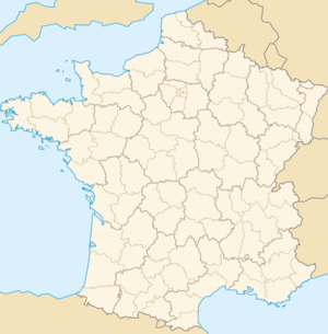
Ubicación de Gurat en Francia

Gurat es una población y comuna francesa, en la región de Poitou-Charentes, departamento de Charente, en el distrito de Angoulême y cantón de Villebois-Lavalette.

Demografía

Datos de población
1962 1968 1975 1982 1990 1999
324 261 216 234 210 184
Para los censos de 1962 a 1999 la población legal corresponde a la población sin duplicidades, según define el INSEE.

Enlaces externos


Wikimedia foundation. 2010.

Игры ⚽ Поможем сделать НИР

Mira otros diccionarios:

  • Gurat — is a commune in the Charente département in western France.ee also*Communes of the Charente department …   Wikipedia

  • Gurat — 45° 25′ 49″ N 0° 16′ 13″ E / 45.4303, 0.2703 …   Wikipédia en Français

  • Lizonne — Nizonne Der Fluss bei Rochebeaucourt et ArgentineVorlage:Infobox Fluss/KARTE fehlt …   Deutsch Wikipedia

  • Lizonne — Pour les articles homonymes, voir Lizonne (affluent de la Charente). la Lizonne (la Nizonne) …   Wikipédia en Français

  • Nizonne — Lizonne Pour les articles homonymes, voir Lizonne (affluent de la Charente). la Lizonne (ou la Nizonne) …   Wikipédia en Français

  • Ronsenac — 45° 28′ 38″ N 0° 15′ 03″ E / 45.4772, 0.2508 …   Wikipédia en Français

  • Saint-Amant (Charente) — Pour les articles homonymes, voir Saint Amant. 45° 23′ 46″ N 0° 09′ 27″ E …   Wikipédia en Français

  • Timeline of Yemen history — * 30th 25th century BC Ancient Arab tribes move North and South. Qahtan and A ad settle South Arabia. The Akkadians and Amalik settle the North. * 23rd century BC The Arabs of the South unite under the leadership of Qahtan. * 21st century BC to… …   Wikipedia

  • List of rulers of Sheba — The following are the two alternative listings of the Rulers of the kingdom of Sheba.Version 1* Samahu Ali ca. 750 BC* Yada il Dharih ?* Yathi amar Watar I ?* Yada il Bayin I ?* Yathi amar Watar II ?* Kariba il Bayin ?* Dhamar Ali Watar ?* Samahu …   Wikipedia

  • List of localities in Malta — This is a list of localities in Malta and Gozo, sorted by council. Malta Attard (ATD)*Attard Industrial Estate code: ATD 3000 *Ħal Warda (Rose Village) code: from ATD 1404 ATD 1409 *Misraħ Kola (Nicholas Square) *Robbu tal Ħemsija code: ATD 4890… …   Wikipedia

Compartir el artículo y extractos

Link directo
Do a right-click on the link above
and select “Copy Link”