Hildale (Utah)

Hildale (Utah)

Hildale es una ciudad del condado de Washington, estado de Utah, Estados Unidos. Según el censo de 2004 la ciudad tiene una población de 1.980 habitantes.

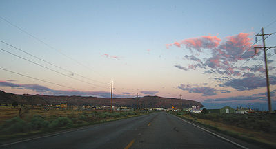
Llegando a Hildale desde el norte por la autopísta Highway 59.

Hildale es una ciudad que se encuentra geográficamente pegada a Colorado City, Arizona, de forma que parecen una única ciudad. Las dos ciudades están junto a la frontera entre los estados de Utah y Arizona. En Hildale está la sede central de la Iglesia Fundamentalista de Jesucristo de los Santos de los Últimos Días (Fundamentalist Church of Jesus Christ of Latter Day Saints o FLDS). Muchos adultos de la comunidad practican la poligamia. De hecho, la mayor parte de funcionarios del gobierno, incluyendo la fuerza de policía son miembros de la FLDS, la comunidad es conocida por tener como una atmósfera de prisión para cualquier mujer que intenta dejar el modo de vivir polígamo.


Wikimedia foundation. 2010.

Игры ⚽ Поможем решить контрольную работу

Mira otros diccionarios:

  • Hildale, Utah — Infobox Settlement official name = Hildale, Utah settlement type = City nickname = motto = imagesize = 250px image caption = Approaching Hildale from the north on State Route 59 image mapsize = 250px map caption = Location of Hildale, Utah… …   Wikipedia

  • Utah locations by per capita income — See also: List of cities in Utah Utah has the thirty ninth highest per capita income in the United States of America, at $18,185 (2000). Its personal per capita income is $24,977 (2003). Utah counties ranked by per capita income There are twenty… …   Wikipedia

  • Hildale — Hildale, UT U.S. city in Utah Population (2000): 1895 Housing Units (2000): 243 Land area (2000): 2.941470 sq. miles (7.618373 sq. km) Water area (2000): 0.000000 sq. miles (0.000000 sq. km) Total area (2000): 2.941470 sq. miles (7.618373 sq. km) …   StarDict's U.S. Gazetteer Places

  • Hildale, UT — U.S. city in Utah Population (2000): 1895 Housing Units (2000): 243 Land area (2000): 2.941470 sq. miles (7.618373 sq. km) Water area (2000): 0.000000 sq. miles (0.000000 sq. km) Total area (2000): 2.941470 sq. miles (7.618373 sq. km) FIPS code:… …   StarDict's U.S. Gazetteer Places

  • Utah State Route 59 — Infobox road state=UT type=SR route=59 section=113 maint=UDOT length mi=22.206 length round=3 length ref=cite web | title=State Route 59 Highway reference | publisher=Utah Department of Transportation |… …   Wikipedia

  • Demographics data of Utah — Demographic information and data regarding the population of the U.S. state of Utah. Began as a territory in 1847 and then granted statehood in 1896, Utah was one of the fastest growing states in the United States throughout the 20th century and… …   Wikipedia

  • Washington County School District (Utah) — Washington County School District is a school district headquartered in St. George, Utah, with 24,297 students enrolled as of October 2006. The district serves students in Washington County, Utah.Washington County School District administrative… …   Wikipedia

  • Duncan's Retreat, Utah — Duncan s Retreat   Ghost town   …   Wikipedia

  • Condado de Washington (Utah) — Para otros usos de este término, véase Condado de Washington. Condado de Washington Condado de los Estados Unidos …   Wikipedia Español

  • National Register of Historic Places listings in Washington County, Utah — Location of Washington County in Utah This is a list of the National Register of Historic Places listings in Washington County, Utah. This is intended to be a complete list of the properties and districts on the National Register of Historic… …   Wikipedia

Compartir el artículo y extractos

Link directo
Do a right-click on the link above
and select “Copy Link”