Marpole

Marpole
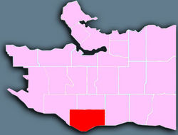
Localización de Marpole en la ciudad de Vancouver.

Marpole es un barrio principalmente residencial con una población de 22.400 habitantes localizado en el sur de la ciudad de Vancouver, Columbia Británica, inmediatamente al noreste del Aeropuerto Internacional de Vancouver. Sus límites son aproximadamente Angus Drive al oeste, la 57th Avenue al norte, Main Street al este y el río Fraser al sur. Ha sufrido muchos cambios durante el siglo XX, con la aparición de un gran tráfico y desarrollo y la construcción del Oak Street Bridge y el Arthur Laing Bridge.


Coordenadas: 49°12′56″N 123°6′50″W / 49.21553, -123.11396


Wikimedia foundation. 2010.

Игры ⚽ Поможем сделать НИР

Mira otros diccionarios:

  • Marpole — Location of Marpole in Vancouver. Marpole is a mostly residential neighbourhood of 22,400[1] located on the southern edge of the city of Vancouver, British Columbia, immediately northeast of Vancouver International Airport. It is approximately… …   Wikipedia

  • Marpole Women's Auxiliary — Marpole Women s Auxiliary.[1] to George Pearson Centre and GF Strong Rehab Centre was established in 1938 in Vancouver, British Columbia to support The Marpole Infirmary located in an area of Vancouver referred to as Marpole. Contents 1 History 2 …   Wikipedia

  • Marpole Loop — s main portion, with the Arthur Laing Bridge on ramps above it Station statistics …   Wikipedia

  • Marpole Bridge — The Marpole Bridge is a swing span railway bridge that crosses the north arm of the Fraser River and connects Vancouver with Richmond, British Columbia. The original Marpole Bridge was constructed in 1902. When it was damaged in 1966, a… …   Wikipedia

  • Oak Street Bridge — Carries Four lanes of British Columbia Highway 99, pedestrians and bicycles Crosses North Arm Fraser River Locale …   Wikipedia

  • Geschichte der Küsten-Salish — Totempfahl vor dem Royal British Columbia Museum in Victoria Die Geschichte der Küsten Salish, einer durch eine gemeinsame Kultur, Verwandtschaft und Sprachen verbundenen Gruppe indianischer Ethnien an der Pazifikküste Nordamerikas, reicht… …   Deutsch Wikipedia

  • Salish de la côte — Pour les articles homonymes, voir Salish (homonymie). Carte des langues salishes de la côte L expression Salishes de la côte …   Wikipédia en Français

  • Arthur Laing Bridge — The Arthur Laing Bridge is a four lane, high level bridge crossing the North Arm of the Fraser River between Vancouver and Richmond, British Columbia s Sea Island where the Vancouver International Airport is located. Two parallel independent… …   Wikipedia

  • 98 B-Line — The 98 B Line is a bus rapid transit line in Greater Vancouver, Canada. It connects Richmond, British Columbia to downtown Vancouver, with a connection to Vancouver International Airport. It travels mainly along Granville Street in Vancouver and… …   Wikipedia

  • List of bus routes in Greater Vancouver — The following list of current bus routes in Greater Vancouver is sorted according to route number. All routes and route names are listed as they appear in TransLink s official bus schedule booklets (shown above). Routes with trolley buses,… …   Wikipedia

Compartir el artículo y extractos

Link directo
Do a right-click on the link above
and select “Copy Link”