Norumbega

Norumbega
Norumbega
Bandera de Norumbega
Bandera
Escudo de Norumbega
Escudo
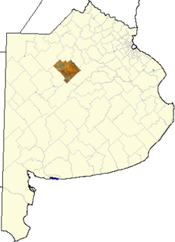
Partido de Nuevede Julio, Argentina.png
País Bandera de Argentina Argentina
• Provincia Buenos Aires Buenos Aires province flag.gif
• Departamento Nueve de Julio
Ubicación 35°31′60″S 60°46′60″O / -35.53333, -60.78333Coordenadas: 35°31′60″S 60°46′60″O / -35.53333, -60.78333
• Altitud 73 msnm
Población 62 hab. (INDEC, 2001)
• Crec.intercensal -1,6% %
Código postal B6501
Pref. telefónico 02317
Intendente Walter Roberto Battistella, UCR
Inf. oficial IFAM BUE089

Norumbega es una localidad del centro de la Provincia de Buenos Aires, Argentina, perteneciente al partido de Nueve de Julio.

Población

Cuenta con 62 habitantes (INDEC, 2001), lo que representa un descenso del 1,6% frente a los 63 habitantes (INDEC, 1991) del censo anterior

Véase también

  • Estación Norumbega

Enlaces externos


Wikimedia foundation. 2010.

Игры ⚽ Поможем написать курсовую

Mira otros diccionarios:

  • Norumbega — Part of Abraham Ortelius atlas from 1570, showing Norvmbega among other more or less mythical names for various areas (as well as several phantom islands). Norumbega (or Norumbègue, Nurumbega, etc) was a legendary settlement in northeastern North …   Wikipedia

  • Norumbega Park — Coordinates: 42°20′46″N 71°15′37″W / 42.34616°N 71.26022°W / 42.34616; 71.26022 …   Wikipedia

  • Norumbega Tower — The Norumbega Tower is a stone tower erected by Eben Norton Horsford in 1889 to mark the supposed location of Fort Norumbega, a Norse fort and city. It is located in Weston, Massachusetts at the confluence of Stony Brook and the Charles River.… …   Wikipedia

  • Norumbega — historian John Fiske’s name for what is now New York City (see Norvegia) …   Eponyms, nicknames, and geographical games

  • Norembergue — Carte du Maine sur l Atlas d Abraham Ortelius (1570) montrant la localisation supposée du Pays de Norembergue (Norvmbega) parmi divers toponymes aujourd hui inusités et quelques îles fantômes. Le pays de Norembergue (en latin Norumbega ou… …   Wikipédia en Français

  • Norumbègue — Norembergue Carte du Maine sur l Atlas d Abraham Ortelius (1570) montrant la localisation supposée du Pays de Norembergue (Norvmbega) parmi divers toponymes aujourd hui inusités et quelques îles fantômes. Le pays de Norembergue (en latin… …   Wikipédia en Français

  • Massachusetts Water Resources Authority — The Massachusetts Water Resources Authority (MWRA) is a public authority in the Commonwealth of Massachusetts that provides wholesale drinking water and sewage services to certain municipalities and industrial users in the state, primarily in the …   Wikipedia

  • Middlesex and Boston Street Railway — The Middlesex and Boston Street Railway (M B) was a streetcar and later bus company in the area west of Boston, Massachusetts. Streetcars last ran in 1930, and in 1972 the company s operations were merged into the Massachusetts Bay Transportation …   Wikipedia

  • Charles River Bike Path — Charles River at night, with the Cambridge bike path on the left side of roadway. Length 23 miles (37 km) Location Boston, Massachusetts to Auburndale …   Wikipedia

  • National Register of Historic Places listings in Knox County, Maine — Location of Knox County in Maine. This is a list of the National Register of Historic Places listings in Knox County, Maine. This is intended to be a complete list of the properties and districts on the National Register of Historic Places in… …   Wikipedia

Compartir el artículo y extractos

Link directo
Do a right-click on the link above
and select “Copy Link”