Piti (Guam)

Piti (Guam)

Piti (Guam)

Piti
Bandera de Piti
Bandera
Escudo de Piti
Escudo
País Guam
Ubicación 13º27´38"N
• Altitud n/d
Población 1.666 hab. (2000 [1])

Piti es una ciudad localizada en la costa oeste de Guam. En ella se encuentra el puerto Apra que es el puerto comercial de Guam, además en Piti están las centrales energéticas de la isla.
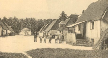
Piti, 1900

Educación

La educación pública de Guam sirve la zona.

Jose Rios Middle School está en Piti.

Véase también

13°27′39″N 144°41′27″E / 13.46083, 144.69083

Obtenido de "Piti (Guam)"

Wikimedia foundation. 2010.

Игры ⚽ Нужно решить контрольную?

Mira otros diccionarios:

  • Piti, Guam — Infobox Settlement settlement type = Village subdivision type = Country subdivision name = United Statessubdivision type1 = Territory subdivision name1 = Guam subdivision type2 = subdivision name2 = timezone=ChST utc offset=+10unit pref=Imperial… …   Wikipedia

  • Guam Highway 1 — Infobox road country=Guam route=1 highway name=Marine Corps Drive maint=Guam Department of Public Works length mi=21.04 length round=2 length ref=cite web | author= U.S. Census Bureau | title=2006 Second Edition TIGER/Line File | date=2006 01 01… …   Wikipedia

  • Guam Public School System — (GPSS, Chamorro: Sisteman Eskuelan Pupblekon Guåhan ), formerly the Guam Department of Education, is a school district that serves the entire island of Guam, a United States insular area. The school district can be thought of as analogous to the… …   Wikipedia

  • Guam — This article is about the United States island territory of Guam. For GUAM, an eastern European international organization, see GUAM Organization for Democracy and Economic Development. Guam Guåhan …   Wikipedia

  • Piti Village — Original name in latin Piti Village Name in other language State code GU Continent/City Pacific/Guam longitude 13.46256 latitude 144.69331 altitude 8 Population 1666 Date 2013 07 07 …   Cities with a population over 1000 database

  • National Register of Historic Places listings in Guam — Map of Guam This is a list of the buildings, sites, districts, and objects listed on the National Register of Historic Places in Guam. There are currently 121 listed sites spread across 17 of the 19 villages of Guam. The villages of Agana Heights …   Wikipedia

  • Diving sites of Guam — Guam has some of the best dive sites in the world since there has been minimal[clarification needed] tourist impact compared to other better known dive locations. Piti Bomb Holes has been built up as a tourist attraction allowing tourists to… …   Wikipedia

  • List of populated places in Guam — Guam This article is part of the series: Politics and government of Guam …   Wikipedia

  • Geography of Guam — Guam Native name: Guåhån Map of Guam (See detailed map) …   Wikipedia

  • Educación pública de Guam — Guam Public School System (en chamorro: Sisteman Eskuelan Pupblekon Guåhan), antiguamente el Departamento de educación de Guam, es un distrito escolar que sirve a la isla de Guam, una área insular perteneciente a los Estados Unidos de América. En …   Wikipedia Español

Compartir el artículo y extractos

Link directo
Do a right-click on the link above
and select “Copy Link”