- QuikSCAT
-
QuikSCAT
QuickSCAT 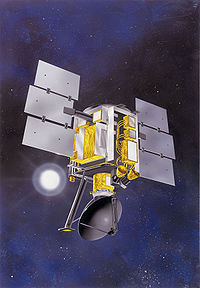
QuickSCATOrganización NASA Estado Activo Satélite de Tierra Fecha de lanzamiento 20 de junio de 1999 Vehículo de lanzamiento Titan Sitio de lanzamiento Vandenberg Aplicación Satélite meteorológico y de observación terrestre Masa 971 kg NSSDC ID 1999-034A QuikSCAT es un satélite artificial de la NASA lanzado el 20 de junio de 1999 mediante un cohete Titan desde la base de Vandenberg.
La misión de QuickSCAT es la de medir la velocidad y dirección del viento sobre los océanos mediante microondas para mejorar la predicción del tiempo y estudiar el desarrollo de las tormentas tropicales.
Referencias
- Wade, Mark (2008). «QuickSCAT» (en inglés). Consultado el 23 de abril de 2009.
Enlaces externos
Categorías: Satélites meteorológicos | Satélites de observación terrestre | Satélites artificiales lanzados en 1999

Wikimedia foundation. 2010.