- Cheslyn Hay
-
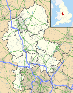
Cheslyn Hay Parroquia civil y pueblo del Reino Unido Ubicación de Cheslyn Hay en Staffordshire. Coordenadas: Entidad Parroquia civil y pueblo • País  Reino Unido
• Nación constitutiva Inglaterra • Región Midlands del Oeste • Condado Staffordshire • Distrito South Staffordshire Superficie • Total 3,77 km² Población (2001) • Total 7.539 hab. • Densidad 1999,73 hab/km² Huso horario GMT (UTC0) • en verano BST (UTC +1) Código postal WS6 Prefijo telefónico 01922 Cheslyn Hay es una parroquia civil y un pueblo del distrito de South Staffordshire, en el condado de Staffordshire (Inglaterra).
Contenido
Geografía
Según la Oficina Nacional de Estadística británica, Cheslyn Hay tiene una superficie de 3,77 km².[1]
Demografía
Según el censo de 2001, Cheslyn Hay tenía 7539 habitantes (50,23% varones, 49,77% mujeres) y una densidad de población de 1999,73 hab/km². El 21,5% eran menores de 16 años, el 74,59% tenían entre 16 y 74, y el 3,91% eran mayores de 74. La media de edad era de 36,74 años. Del total de habitantes con 16 o más años, el 24,37% estaban solteros, el 63,08% casados, y el 12,55% divorciados o viudos.[2]
Según su grupo étnico, el 98,4% de los habitantes eran blancos, el 0,44% mestizos, el 0,81% asiáticos, el 0,15% negros, el 0,12% chinos, y el 0,04% de cualquier otro. La mayor parte (98,45%) eran originarios del Reino Unido. El resto de países europeos englobaban al 0,62% de la población, mientras que el 0,93% había nacido en cualquier otro lugar. El cristianismo era profesado por el 83,57%, el hinduismo por el 0,19%, el islam por el 0,12%, el sijismo por el 0,4%, y cualquier otra religión, salvo el budismo y el judaísmo, por el 0,09%. El 9,29% no eran religiosos y el 6,34% no marcaron ninguna opción en el censo.[1]
Había 2863 hogares con residentes y 80 vacíos.[2]
Referencias
- ↑ a b Tablas: «Usual Resident Population (KS01) for Amalgamated Parishes», «Ethnic Group (KS06) for Amalgamated Parishes», «Country of Birth (KS05) for Amalgamated Parishes» y «Religion (KS07) for Amalgamated Parishes», disponibles para descarga aquí. Office for National Statistics (inglés).
- ↑ a b «Area: Cheslyn Hay CP (Parish)» (en inglés). Office for National Statistics. Consultado el 8 de septiembre de 2011.
Enlaces externos
 Wikimedia Commons alberga contenido multimedia sobre Cheslyn Hay. Commons
- Ficha de Cheslyn Hay en el sitio web oficial del Ayuntamiento de South Staffordshire (en inglés).
Categorías:- Localidades de Staffordshire
- Parroquias civiles de Staffordshire
Wikimedia foundation. 2010.

