- Chesterland (Ohio)
-
Chesterland Lugar designado por el censo de los Estados Unidos Ubicación en el condado de Geauga en Ohio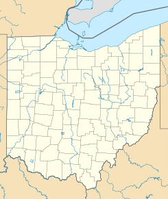
 Chesterland
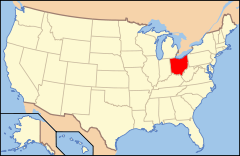
Ubicación de Ohio en EE. UU.Coordenadas: Entidad Lugar designado por el censo • País  Estados Unidos
• Estado  Ohio
Ohio• Condado Geauga Superficie • Total 11,37 km² • Tierra 11,34 km² • Agua (0,32%) 0,04 km² Altitud • Media 370 msnm Población (2010) • Total 2.521 hab. • Densidad 221,67 hab/km² Huso horario Este: UTC-5 • en verano UTC-4 Código ZIP 44026 Código de área 440 GNIS 2393375[1] Chesterland es un lugar designado por el censo ubicado en el condado de Geauga en el estado estadounidense de Ohio. En el Censo de 2010 tenía una población de 2521 habitantes y una densidad poblacional de 221,67 personas por km².[2]
Contenido
Geografía
Chesterland se encuentra ubicado en las coordenadas . Según la Oficina del Censo de los Estados Unidos, Chesterland tiene una superficie total de 11.37 km², de la cual 11.34 km² corresponden a tierra firme y (0.32%) 0.04 km² es agua.[3]
Demografía
Según el censo de 2010,[4] había 2521 personas residiendo en Chesterland. La densidad de población era de 221,67 hab./km². De los 2521 habitantes, Chesterland estaba compuesto por el 97.58% blancos, el 0.87% eran afroamericanos, el 0.04% eran amerindios, el 0.4% eran asiáticos, el 0% eran isleños del Pacífico, el 0.12% eran de otras razas y el 0.99% pertenecían a dos o más razas. Del total de la población el 2.42% eran hispanos o latinos de cualquier raza.[5]
Referencias
- ↑ «Sistema de Información de Nombres Geográficos: Chesterland (Ohio)». Geographic Names Information System (en inglés) Consultado el 19 de noviembre de 2011.
- ↑ «U.S. Gazetteer: Censo de 2010» (en inglés). Oficina del Censo de los Estados Unidos (16 de febrero de 2011). Consultado el 11 de julio de 2011.
- ↑ «Encuentra un condado» (en inglés). Asociación Nacional de Condados (11 de julio de 2011). Consultado el 11 de julio de 2011.
- ↑ «American FactFinder» (en inglés). Oficina del Censo de los Estados Unidos. Consultado el 11 de julio de 2011.
- ↑ «US Board on Geographic Names» (en inglés). Servicio Geológico de los Estados Unidos (25 de octubre de 2007). Consultado el 11 de julio de 2011.
Enlaces externos
 Portal:Ohio. Contenido relacionado con Ohio.
Categorías:- Lugares designados por el censo en Ohio
- Localidades del condado de Geauga


Wikimedia foundation. 2010.