Collettsville

Collettsville
Collettsville
Área no incorporada de los Estados Unidos
Collettsville
Collettsville
Ubicación en el condado de Caldwell en Carolina del Norte
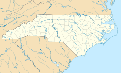
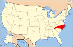
Ubicación de Carolina del Norte en EE. UU.
35°55′32″N 81°40′28″O / 35.92556, -81.67444Coordenadas: 35°55′32″N 81°40′28″O / 35.92556, -81.67444
Entidad Área no incorporada
 • País Bandera de los Estados Unidos Estados Unidos
 • Estado Flag of North Carolina.svg Carolina del Norte
 • Condado Caldwell
Superficie  
 • Total mi² km²
 • Tierra mi² km²
 • Agua (0,0%) 0,0 mi² 0,0 km²
Huso horario Este: UTC-5
 • en verano UTC-4
Prefijo telefónico 828

Collettsville es una pequeña área no incorporada ubicada del condado de Caldwell en el estado estadounidense de Carolina del Norte.[1]

Referencias

  1. «U.S. Gazetteer: Censo de 2010» (en inglés). Oficina del Censo de los Estados Unidos (16 de febrero de 2011). Consultado el 11 de julio de 2011.

Enlaces externos

Coordenadas: 35°55′32″N 81°40′28″O / 35.92556, -81.67444


Wikimedia foundation. 2010.

Игры ⚽ Поможем написать реферат

Mira otros diccionarios:

  • Collettsville, North Carolina — Country United States State North Carolina Counties Caldwell Area code(s) 828 Collettsville (pronounced coh lets ville) is a small unincorporated commun …   Wikipedia

  • 28611 — Collettsville, Nc (Miscellaneous » ZIP Codes) …   Abbreviations dictionary

  • Caldwell County, North Carolina — Infobox U.S. County county = Caldwell County state = North Carolina map size = 250 founded = 1841 seat = Lenoir | area total sq mi =474 area water sq mi =3 area percentage = 0.57% census yr = 2000 pop = 77415 density km2 =63 web = www.co.caldwell …   Wikipedia

  • Northlakes, North Carolina —   CDP   …   Wikipedia

  • List of unincorporated communities in North Carolina — The following is a partial list of named, but unincorporated communities in the state of North Carolina. To be listed, the unincorporated community should either be a Census Designated Place (CDP) or a place with at least a few commercial… …   Wikipedia

  • Western North Carolina — The counties most commonly associated with Western North Carolina. Western North Carolina (often abbreviated as WNC) is the region of North Carolina which includes the Appalachian Mountains, thus it is often known geographically as the state s… …   Wikipedia

  • North Carolina Highway 90 — NC 90 Route information Maintained by NCDOT Length: 71.5 mi[1] …   Wikipedia

  • The Unifour — The Hickory Lenoir Morganton Metropolitan Statistical Area, as defined by the United States Census Bureau, is an area consisting of four counties in the Catawba Valley region of western North Carolina. Local residents often refer to the area as… …   Wikipedia

  • National Register of Historic Places listings in Caldwell County, North Carolina — Map of all coordinates from Google Map of all coordinates from Bing …   Wikipedia

  • Condado de Caldwell (Carolina del Norte) — Para otros usos de este término, véase Condado de Caldwell. Condado de Caldwell Condado de los Estados Unidos …   Wikipedia Español

Compartir el artículo y extractos

Link directo
Do a right-click on the link above
and select “Copy Link”