- Fulford (Staffordshire)
-
Fulford Parroquia civil y pueblo del Reino Unido 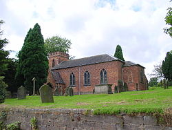
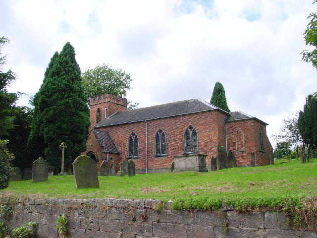
Iglesia de San Nicolás, en Fulford.Ubicación de Fulford en Staffordshire.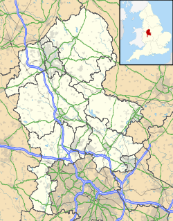
 Fulford
Coordenadas: Entidad Parroquia civil y pueblo • País  Reino Unido
• Nación constitutiva Inglaterra • Región Midlands del Oeste • Condado Staffordshire • Distrito Stafford Superficie • Total 14,91 km² Población (2001) • Total 5.579 hab. • Densidad 374,18 hab/km² Huso horario GMT (UTC0) • en verano BST (UTC +1) Código postal ST11 Prefijo telefónico 01889 Fulford es una parroquia civil y un pueblo del distrito de Stafford, en el condado de Staffordshire (Inglaterra).
Geografía
Según la Oficina Nacional de Estadística británica, Fulford tiene una superficie de 14,91 km².[1]
Demografía
Según el censo de 2001, Fulford tenía 5579 habitantes (48,93% varones, 51,07% mujeres) y una densidad de población de 374,18 hab/km². El 15,11% eran menores de 16 años, el 75,34% tenían entre 16 y 74, y el 9,55% eran mayores de 74. La media de edad era de 44,76 años. Del total de habitantes con 16 o más años, el 20,29% estaban solteros, el 64% casados, y el 15,71% divorciados o viudos.[2]
Según su grupo étnico, el 98,8% de los habitantes eran blancos, el 0,41% mestizos, el 0,48% asiáticos, el 0,25% negros, y el 0,05% chinos. La mayor parte (97,9%) eran originarios del Reino Unido. El resto de países europeos englobaban al 0,68% de la población, mientras que el 1,42% había nacido en cualquier otro lugar. El cristianismo era profesado por el 84,17%, el budismo por el 0,07%, el hinduismo por el 0,22%, el islam por el 0,2%, el sijismo por el 0,05%, y cualquier otra religión, salvo el judaísmo, por el 0,27%. El 7,94% no eran religiosos y el 7,08% no marcaron ninguna opción en el censo.[1]
Había 2328 hogares con residentes, 47 vacíos, y 3 eran alojamientos vacacionales o segundas residencias.[2]
Referencias
- ↑ a b Tablas: «Usual Resident Population (KS01) for Amalgamated Parishes», «Ethnic Group (KS06) for Amalgamated Parishes», «Country of Birth (KS05) for Amalgamated Parishes» y «Religion (KS07) for Amalgamated Parishes», disponibles para descarga aquí. Office for National Statistics (inglés).
- ↑ a b «Area: Fulford CP (Parish)» (en inglés). Office for National Statistics. Consultado el 11 de octubre de 2011.
Categorías:- Localidades de Staffordshire
- Parroquias civiles de Staffordshire

Wikimedia foundation. 2010.