Greers Ferry (Arkansas)

Greers Ferry (Arkansas)
Greers Ferry
Ciudad de los Estados Unidos
Greers Ferry
Greers Ferry
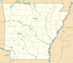
Ubicación en el condado de Cleburne en Arkansas
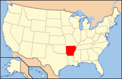
Ubicación de Arkansas en EE. UU.
35°34′4″N 92°10′10″O / 35.56778, -92.16944Coordenadas: 35°34′4″N 92°10′10″O / 35.56778, -92.16944
Entidad Ciudad
 • País Bandera de los Estados Unidos Estados Unidos
 • Estado Bandera de Arkansas Arkansas
 • Condado Cleburne
Superficie  
 • Total 18,68 km²
 • Tierra 18,66 km²
 • Agua (0,14%) 0,03 km²
Altitud  
 • Media 164 msnm
Población (2010)  
 • Total 891 hab.
 • Densidad 47,69 hab/km²
Huso horario Centro: UTC-6
 • en verano UTC-5
GNIS 2403759[1]

Greers Ferry es una ciudad ubicada en el condado de Cleburne en el estado estadounidense de Arkansas. En el Censo de 2010 tenía una población de 891 habitantes y una densidad poblacional de 47,69 personas por km².[2]

Contenido

Geografía

Greers Ferry se encuentra ubicada en las coordenadas 35°34′4″N 92°10′10″O / 35.56778, -92.16944. Según la Oficina del Censo de los Estados Unidos, Greers Ferry tiene una superficie total de 18.68 km², de la cual 18.66 km² corresponden a tierra firme y (0.14%) 0.03 km² es agua.[3]

Demografía

Según el censo de 2010,[4] había 891 personas residiendo en Greers Ferry. La densidad de población era de 47,69 hab./km². De los 891 habitantes, Greers Ferry estaba compuesto por el 98.09% blancos, el 0% eran afroamericanos, el 0.22% eran amerindios, el 0.22% eran asiáticos, el 0% eran isleños del Pacífico, el 1.01% eran de otras razas y el 0.45% pertenecían a dos o más razas. Del total de la población el 2.58% eran hispanos o latinos de cualquier raza.[5]

Referencias

  1. «Sistema de Información de Nombres Geográficos: Greers Ferry (Arkansas)». Geographic Names Information System (en inglés) Consultado el 21 de noviembre de 2011.
  2. «U.S. Gazetteer: Censo de 2010» (en inglés). Oficina del Censo de los Estados Unidos (16 de febrero de 2011). Consultado el 11 de julio de 2011.
  3. «Encuentra un condado» (en inglés). Asociación Nacional de Condados (11 de julio de 2011). Consultado el 11 de julio de 2011.
  4. «American FactFinder» (en inglés). Oficina del Censo de los Estados Unidos. Consultado el 11 de julio de 2011.
  5. «US Board on Geographic Names» (en inglés). Servicio Geológico de los Estados Unidos (25 de octubre de 2007). Consultado el 11 de julio de 2011.

Enlaces externos


Wikimedia foundation. 2010.

Игры ⚽ Поможем решить контрольную работу

Mira otros diccionarios:

  • Greers Ferry, Arkansas — Infobox Settlement official name = Greers Ferry, Arkansas settlement type = City imagesize = image caption = image imagesize = image caption = image mapsize = 250px map caption = Location in Cleburne County and the state of Arkansas mapsize1 =… …   Wikipedia

  • Greers Ferry — Greers Ferry, Arkansas Bandera …   Wikipedia Español

  • Greers Ferry Dam — is a dam on the Little Red River in Cleburne County in the U.S. state of Arkansas. It impounds Greers Ferry Lake.The dam is located at coord|35|31|15|N|91|59|36|W| north of Little Rock. It was dedicated in October, 1963 by President John F.… …   Wikipedia

  • Greers Ferry — Greers Ferry, AR U.S. city in Arkansas Population (2000): 930 Housing Units (2000): 664 Land area (2000): 7.128597 sq. miles (18.462980 sq. km) Water area (2000): 0.015169 sq. miles (0.039288 sq. km) Total area (2000): 7.143766 sq. miles… …   StarDict's U.S. Gazetteer Places

  • Greers Ferry, AR — U.S. city in Arkansas Population (2000): 930 Housing Units (2000): 664 Land area (2000): 7.128597 sq. miles (18.462980 sq. km) Water area (2000): 0.015169 sq. miles (0.039288 sq. km) Total area (2000): 7.143766 sq. miles (18.502268 sq. km) FIPS… …   StarDict's U.S. Gazetteer Places

  • Greers Ferry Lake — Infobox lake lake name = Greers Ferry Lake image lake = Gferrydam.jpg caption lake = Greers Ferry Dam image bathymetry = caption bathymetry = location = Northern Arkansas, mostly in Heber Springs coords = type = reservoir inflow = Little Red… …   Wikipedia

  • Arkansas locations by per capita income — Arkansas is the forty eighth richest state in the United States of America, with a per capita income of $16,904 (2000). Arkansas Places Ranked by Per Capita Income # Morrison Bluff, Arkansas ndash; $56,436 # Prairie Creek, Arkansas ndash; $37,355 …   Wikipedia

  • Little Red River (Arkansas) — The Little Red River is a river in north central Arkansas. During the American Civil War the Battle of Whitney s Lane took place near Searcy on the banks of the Little Red.The upper tributaries of the Little Red River are known as the South Fork …   Wikipedia

  • Cleburne County, Arkansas — Location in the state of Arkansas …   Wikipedia

  • Drasco, Arkansas — Drasco is an unincorporated community in Cleburne County, Arkansas, with a ZIP code of 72530.[1] Drasco lies just northeast of Greers Ferry Lake and includes the community of Tannenbaum. Drasco has a small food mart, a couple of restaurants, and… …   Wikipedia

Compartir el artículo y extractos

Link directo
Do a right-click on the link above
and select “Copy Link”