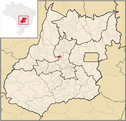
Heitoraí

Heitoraí
Heitoraí
Mapa
Mapa
Coordenadas: 15°43′08″S 49°49′44″O / -15.71889, -49.82889Coordenadas: 15°43′08″S 49°49′44″O / -15.71889, -49.82889
Entidad Municipio
 • País Bandera de Brasil Brasil
 • Estado Goiás
 • Mesorregión Centro Goiano
 • Microrregión Anápolis
Superficie  
 • Total 229.666 km²
Población (est. IBGE/2009[1] )  
 • Total 3,706 hab.
 • Densidad 16,4 hab/km²
PIB (nominal)  
 • Total 13.512 mil
 • PIB per cápita 3.641,00
IDH (PNUD/2000[2] ) 0.744
Huso horario -3
Datos mesorregión IBGE/2008[3]
Datos microrregión IBGE/2008[3]

Heitoraí es un municipio brasilero del estado de Goiás. Su población estimada en 2004 era de 3.663 habitantes.

Referencias

  1. «Estimaciones de la población para 1º de julio de 2009». Instituto Brasileiro de Geografia e Estatística (IBGE) (14 de agosto de 2009). Consultado el 16 de agosto de 2009.
  2. «Ranking decrescente del IDH-M de los municipios del Brasil». Programa das Nações Unidas para o Desenvolvimento (PNUD) (2000). Consultado el 11 de octubre de 2008.
  3. a b «División Territorial del Brasil». Instituto Brasileiro de Geografia e Estatística (IBGE) (1 de julio de 2008). Consultado el 11 de octubre de 2008.

Wikimedia foundation. 2010.

Игры ⚽ Нужно решить контрольную?

Mira otros diccionarios:

  • Heitoraí — is a small town and municipality in central Goiás state, Brazil. LocationHeitoraí lies 142 km. from the regional center of Anápolis. Highway connections are made by federal highway BR 153 from Goiânia to Itaberaí then north on GO 156 for 38… …   Wikipedia

  • Heitorai — Admin ASC 2 Code Orig. name Heitoraí Country and Admin Code BR.29.5209606 BR …   World countries Adminstrative division ASC I-II

  • Heitoraí (Goiás) — Heitoraí Wappen Flagge …   Deutsch Wikipedia

  • Cleber Resende de Oliveira — Cleber Goiano Personal information Full name Cleber Resende de Oliveira Date of birth January 6, 1979 ( …   Wikipedia

  • Itaberaí (Goiás) — Wappen Flagge …   Deutsch Wikipedia

  • Itapuranga — is a small town and municipality in northern Goiás state, Brazil. Location and ClimateItapuranga is located northwest of Goiânia and north of Goiás, the old capital of the state. *Main highways of access from Goiânia are G0 070 to Itaberaí and… …   Wikipedia

  • Муниципалитеты штата Гояс — …   Википедия

  • Эйтораи — Муниципалитет Эйтораи Heitoraí Страна БразилияБразилия …   Википедия

  • Mikroregion Anápolis (Goiás) — Mikroregion Anápolis Karte …   Deutsch Wikipedia

  • Anápolis Microregion — Location of the Anápolis Microregion in the state of Goiás The Anápolis Microregion is a region of central Goiás state, Brazil, including municipalities surrounding the city of Anápolis. For a map see City Brazil Population: 517,221 inha …   Wikipedia

Compartir el artículo y extractos

Link directo
Do a right-click on the link above
and select “Copy Link”