Kent Narrows

Kent Narrows
Kent Narrows
Lugar designado por el censo de los Estados Unidos
Kent Narrows
Kent Narrows
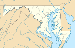
Ubicación en el condado de Queen Anne en Maryland
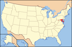
Ubicación de Maryland en EE. UU.
38°58′15″N 76°13′58″O / 38.97083, -76.23278Coordenadas: 38°58′15″N 76°13′58″O / 38.97083, -76.23278
Entidad Lugar designado por el censo
 • País Bandera de los Estados Unidos Estados Unidos
 • Estado Bandera de Maryland Maryland
 • Condado Queen Anne
Superficie  
 • Total 8,35 km²
 • Tierra 2,56 km²
 • Agua (69,3%) 5,79 km²
Altitud  
 • Media 0 msnm
Población (2010)  
 • Total 567 hab.
 • Densidad 67,88 hab/km²
Huso horario Este: UTC-5
 • en verano UTC-4
GNIS 2389997[1]

Kent Narrows es un lugar designado por el censo ubicado en el condado de Queen Anne en el estado estadounidense de Maryland. En el Censo de 2010 tenía una población de 567 habitantes y una densidad poblacional de 67,88 personas por km².[2]

Contenido

Geografía

Kent Narrows se encuentra ubicado en las coordenadas 38°58′15″N 76°13′58″O / 38.97083, -76.23278. Según la Oficina del Censo de los Estados Unidos, Kent Narrows tiene una superficie total de 8.35 km², de la cual 2.56 km² corresponden a tierra firme y (69.3%) 5.79 km² es agua.[3]

Demografía

Según el censo de 2010,[4] había 567 personas residiendo en Kent Narrows. La densidad de población era de 67,88 hab./km². De los 567 habitantes, Kent Narrows estaba compuesto por el 97.35% blancos, el 1.59% eran afroamericanos, el 0% eran amerindios, el 0.71% eran asiáticos, el 0% eran isleños del Pacífico, el 0% eran de otras razas y el 0.35% pertenecían a dos o más razas. Del total de la población el 0.18% eran hispanos o latinos de cualquier raza.[5]

Referencias

  1. «Sistema de Información de Nombres Geográficos: Kent Narrows». Geographic Names Information System (en inglés) Consultado el 22 de noviembre de 2011.
  2. «U.S. Gazetteer: Censo de 2010» (en inglés). Oficina del Censo de los Estados Unidos (16 de febrero de 2011). Consultado el 11 de julio de 2011.
  3. «Encuentra un condado» (en inglés). Asociación Nacional de Condados (11 de julio de 2011). Consultado el 11 de julio de 2011.
  4. «American FactFinder» (en inglés). Oficina del Censo de los Estados Unidos. Consultado el 11 de julio de 2011.
  5. «US Board on Geographic Names» (en inglés). Servicio Geológico de los Estados Unidos (25 de octubre de 2007). Consultado el 11 de julio de 2011.

Enlaces externos


Wikimedia foundation. 2010.

Игры ⚽ Поможем решить контрольную работу

Mira otros diccionarios:

  • Kent Narrows — Kent Narrows, MD U.S. Census Designated Place in Maryland Population (2000): 567 Housing Units (2000): 358 Land area (2000): 0.983003 sq. miles (2.545965 sq. km) Water area (2000): 1.607017 sq. miles (4.162155 sq. km) Total area (2000): 2.590020… …   StarDict's U.S. Gazetteer Places

  • Kent Narrows, MD — U.S. Census Designated Place in Maryland Population (2000): 567 Housing Units (2000): 358 Land area (2000): 0.983003 sq. miles (2.545965 sq. km) Water area (2000): 1.607017 sq. miles (4.162155 sq. km) Total area (2000): 2.590020 sq. miles… …   StarDict's U.S. Gazetteer Places

  • Kent Narrows — This article is about the body of water, for the community, see Kent Narrows, Maryland The Kent Narrows, also known as Kent Island Narrows and to local residents simply as the Narrows, is a waterway that connects the Chester River with Eastern… …   Wikipedia

  • Kent Narrows, Maryland — This article is about the community, for the body of water see Kent Narrows Infobox Settlement official name = Kent Narrows, Maryland settlement type = CDP nickname = motto = imagesize = image caption = image imagesize = image caption = image… …   Wikipedia

  • Kent Island, Maryland — Kent Island is the largest island in the Chesapeake Bay, and a historic place in Maryland. To the east, a narrow channel known as the Kent Narrows barely separates the island from the Delmarva Peninsula, and on the other side, the island is… …   Wikipedia

  • Kent (disambiguation) — Kent comes from the Kingdom of Kent, and probably from the Cantiaci tribe. Kent is also a word from old Turkic which means city .It may refer to:People see Kent (surname) Kent (band) is a Swedish rock bandPlacesCanada*Kent, British Columbia… …   Wikipedia

  • Narrows — For other uses, see The Narrows (disambiguation). Kent Narrows separating Kent Island from the Eastern Shore of Maryland. Narrows is a term for restricted land or water passages. Most commonly it refers to a strait, though it can also refer to a… …   Wikipedia

  • Narrows Bridge (Perth) — The Narrows Bridge seen prior to the completion of the railway line The Narrows Bridge is a freeway crossing of the Swan River in Perth, Western Australia, at The Narrows between Mill Point and Mount Eliza. Made up of two road bridges and a… …   Wikipedia

  • The Narrows (disambiguation) — The Narrows is a strait in New York City separating Long Island and Staten IslandThe Narrows is also the name of several geographic features around the world: United States *The Narrows (Zion National Park), along the North Fork Virgin River in… …   Wikipedia

  • The Narrows (desambiguación) — The Narrows es un estrello de la Ciudad de Nueva York que separa a Long Island y Staten Island. The Narrows es también el nombre de varios lugares alrededor del mundo. Estados Unidos The Narrows (Parque Nacional Zion), a lo largo del Río North… …   Wikipedia Español

Compartir el artículo y extractos

Link directo
Do a right-click on the link above
and select “Copy Link”