Lake of the Woods (Arizona)

Lake of the Woods (Arizona)
Lake of the Woods
Lugar designado por el censo de los Estados Unidos
Lake of the Woods
Lake of the Woods
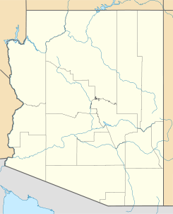
Ubicación en el condado de Navajo en Arizona
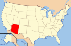
Ubicación de Arizona en EE. UU.
34°9′9″N 109°59′40″O / 34.1525, -109.99444Coordenadas: 34°9′9″N 109°59′40″O / 34.1525, -109.99444
Entidad Lugar designado por el censo
 • País Bandera de los Estados Unidos Estados Unidos
 • Estado Bandera de Arizona Arizona
 • Condado Navajo
Superficie  
 • Total 10,73 km²
 • Tierra 10,27 km²
 • Agua (4,3%) 0,46 km²
Altitud  
 • Media 2061 msnm
Población (2010)  
 • Total 4,094 hab.
 • Densidad 381,54 hab/km²
Huso horario Montaña: UTC-7
GNIS 2582812[1]

Lake of the Woods es un lugar designado por el censo ubicado en el condado de Navajo en el estado estadounidense de Arizona. En el Censo de 2010 tenía una población de 4.094 habitantes y una densidad poblacional de 381,54 personas por km².[2]

Contenido

Geografía

Lake of the Woods se encuentra ubicado en las coordenadas 34°9′9″N 109°59′40″O / 34.1525, -109.99444. Según la Oficina del Censo de los Estados Unidos, Lake of the Woods tiene una superficie total de 10.73 km², de la cual 10.27 km² corresponden a tierra firme y (4.3%) 0.46 km² es agua.[3]

Demografía

Según el censo de 2010,[4] había 4.094 personas residiendo en Lake of the Woods. La densidad de población era de 381,54 hab./km². De los 4.094 habitantes, Lake of the Woods estaba compuesto por el 86.1% blancos, el 0.56% eran afroamericanos, el 2.42% eran amerindios, el 0.73% eran asiáticos, el 0.02% eran isleños del Pacífico, el 7.62% eran de otras razas y el 2.54% pertenecían a dos o más razas. Del total de la población el 19.59% eran hispanos o latinos de cualquier raza.[5]

Referencias

  1. «Sistema de Información de Nombres Geográficos: Lake of the Woods (Arizona)». Geographic Names Information System (en inglés) Consultado el 22 de noviembre de 2011.
  2. «U.S. Gazetteer: Censo de 2010» (en inglés). Oficina del Censo de los Estados Unidos (16 de febrero de 2011). Consultado el 11 de julio de 2011.
  3. «Encuentra un condado» (en inglés). Asociación Nacional de Condados (11 de julio de 2011). Consultado el 11 de julio de 2011.
  4. «American FactFinder» (en inglés). Oficina del Censo de los Estados Unidos. Consultado el 11 de julio de 2011.
  5. «US Board on Geographic Names» (en inglés). Servicio Geológico de los Estados Unidos (25 de octubre de 2007). Consultado el 11 de julio de 2011.

Enlaces externos


Wikimedia foundation. 2010.

Игры ⚽ Нужно решить контрольную?

Mira otros diccionarios:

  • The United States of America —     The United States of America     † Catholic Encyclopedia ► The United States of America     BOUNDARIES AND AREA     On the east the boundary is formed by the St. Croix River and an arbitrary line to the St. John, and on the north by the… …   Catholic encyclopedia

  • The Cove Palisades State Park — Lake Billy Chinook Lake Billy Chinook and The Island, with state park facilities below Location Jefferson County, Oregon Coordinates …   Wikipedia

  • Woods Canyon Lake — Infobox lake lake name = Woods Canyon Lake image lake = Woodscynlake.jpg caption lake = image bathymetry = caption bathymetry = location = Arizona coords = coord|34|20|22|N|110|57|9|W|region:US AZ type:waterbody|display=inline,title type =… …   Wikipedia

  • County statistics of the United States — The counties are used in 48 of the 50 states of the United States for the level of local government below the state itself. Louisiana uses parishes, and Alaska uses boroughs. In several states in New England, some or all counties within states… …   Wikipedia

  • lake — lake1 /layk/, n. 1. a body of fresh or salt water of considerable size, surrounded by land. 2. any similar body or pool of other liquid, as oil. 3. (go) jump in the lake, (used as an exclamation of dismissal or impatience.) [bef. 1000; ME lak(e) …   Universalium

  • Lake — /layk/, n. Simon, 1866 1945, U.S. engineer and naval architect. * * * I Relatively large body of slow moving or standing water that occupies an inland basin. Lakes are most abundant in high northern latitudes and in mountain regions, particularly …   Universalium

  • Catholic Indian Missions of the United States —     Catholic Indian Missions of the United States     † Catholic Encyclopedia ► Catholic Indian Missions of the United States     The spiritual welfare of the native tribes of America was a subject of deep concern to the Governments of Catholic… …   Catholic encyclopedia

  • Territorial evolution of the United States — This is a list of the evolution of the borders of the United States. This lists each change to the internal and external borders of the country, as well as status and name changes. It also shows the surrounding areas that eventually became part… …   Wikipedia

  • Monson Lake State Park — Coordinates: 45°19′14″N 95°16′13″W / 45.32056°N 95.27028°W / 45.32056; 95.27028 …   Wikipedia

  • The Woodlands High School — Address 6101 Research Forest Drive The Woodlands, Texas, 77381 United States Information School type Public high school …   Wikipedia

Compartir el artículo y extractos

Link directo
Do a right-click on the link above
and select “Copy Link”