Lime Springs (Iowa)

Lime Springs (Iowa)
Lime Springs
Ciudad de los Estados Unidos
Lime Springs
Lime Springs
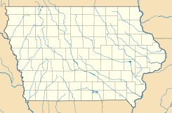
Ubicación en el condado de Howard en Iowa
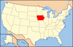
Ubicación de Iowa en EE. UU.
43°26′59″N 92°17′3″O / 43.44972, -92.28417Coordenadas: 43°26′59″N 92°17′3″O / 43.44972, -92.28417
Entidad Ciudad
 • País Bandera de los Estados Unidos Estados Unidos
 • Estado Bandera de Iowa Iowa
 • Condado Howard
Superficie  
 • Total 2,64 km²
 • Tierra 2,64 km²
 • Agua (0%) 0 km²
Altitud  
 • Media 381 msnm
Población (2010)  
 • Total 505 hab.
 • Densidad 191,53 hab/km²
Huso horario Centro: UTC-6
 • en verano UTC-5
GNIS 2395709[1]

Lime Springs es una ciudad ubicada en el condado de Howard en el estado estadounidense de Iowa. En el Censo de 2010 tenía una población de 505 habitantes y una densidad poblacional de 191,53 personas por km².[2]

Contenido

Geografía

Lime Springs se encuentra ubicada en las coordenadas 43°26′59″N 92°17′3″O / 43.44972, -92.28417. Según la Oficina del Censo de los Estados Unidos, Lime Springs tiene una superficie total de 2.64 km², de la cual 2.64 km² corresponden a tierra firme y (0%) 0 km² es agua.[3]

Demografía

Según el censo de 2010,[4] había 505 personas residiendo en Lime Springs. La densidad de población era de 191,53 hab./km². De los 505 habitantes, Lime Springs estaba compuesto por el 99.41% blancos, el 0% eran afroamericanos, el 0.2% eran amerindios, el 0.4% eran asiáticos, el 0% eran isleños del Pacífico, el 0% eran de otras razas y el 0% pertenecían a dos o más razas. Del total de la población el 0.4% eran hispanos o latinos de cualquier raza.[5]

Referencias

  1. «Sistema de Información de Nombres Geográficos: Lime Springs (Iowa)». Geographic Names Information System (en inglés) Consultado el 22 de noviembre de 2011.
  2. «U.S. Gazetteer: Censo de 2010» (en inglés). Oficina del Censo de los Estados Unidos (16 de febrero de 2011). Consultado el 11 de julio de 2011.
  3. «Encuentra un condado» (en inglés). Asociación Nacional de Condados (11 de julio de 2011). Consultado el 11 de julio de 2011.
  4. «American FactFinder» (en inglés). Oficina del Censo de los Estados Unidos. Consultado el 11 de julio de 2011.
  5. «US Board on Geographic Names» (en inglés). Servicio Geológico de los Estados Unidos (25 de octubre de 2007). Consultado el 11 de julio de 2011.

Enlaces externos


Wikimedia foundation. 2010.

Игры ⚽ Нужно сделать НИР?

Mira otros diccionarios:

  • Lime Springs, Iowa — Infobox Settlement official name = Lime Springs, Iowa settlement type = City nickname = motto = imagesize = image caption = image imagesize = image caption = image mapsize = 250x200px map caption = Location of Lime Springs, Iowa mapsize1 = map… …   Wikipedia

  • Lime Springs — Lime Springs, IA U.S. city in Iowa Population (2000): 496 Housing Units (2000): 243 Land area (2000): 1.016799 sq. miles (2.633498 sq. km) Water area (2000): 0.000000 sq. miles (0.000000 sq. km) Total area (2000): 1.016799 sq. miles (2.633498 sq …   StarDict's U.S. Gazetteer Places

  • Lime Springs, IA — U.S. city in Iowa Population (2000): 496 Housing Units (2000): 243 Land area (2000): 1.016799 sq. miles (2.633498 sq. km) Water area (2000): 0.000000 sq. miles (0.000000 sq. km) Total area (2000): 1.016799 sq. miles (2.633498 sq. km) FIPS code:… …   StarDict's U.S. Gazetteer Places

  • Nora Springs, Iowa —   City   Location of Nora Spr …   Wikipedia

  • Iowa Highway 157 — Infobox road state=IA type=IA route=157 alternate name= length mi= length round= length ref= established=1931 decommissioned=July 1, 2003 direction a=West starting terminus=Jct|state=IA|US|63 near Lime Springs junction= direction b=East ending… …   Wikipedia

  • Iowa highway jurisdictional transfer (2003) — Main article: List of Iowa state highways On July 1, 2003, the Iowa Department of Transportation transferred control of more than 600 miles (970 km) of highway to county and local governments in order to save money and to increase… …   Wikipedia

  • Iowa Highway 9 — Infobox road state=IA type=IA route=9 alternate name= length mi=296 length round=0 length ref=Iowahighwaysref|lowrg=1|hirng=9|num=9|access date=November 8, 2007] established= direction a=West starting terminus= junction= direction b=East ending… …   Wikipedia

  • National Register of Historic Places listings in Iowa — …   Wikipedia

  • Upper Iowa River — The Upper Iowa River is a tributary of the Mississippi River in the upper Midwest of the United States.Its headwaters are in southeastern Minnesota, in Mower County (Le Roy and Lodi townships) near the border with Iowa. It then flows through the… …   Wikipedia

  • Liste der Städte in Iowa — Die folgende Liste zeigt alle Kommunen und Siedlungen in Iowa. Sie enthält sowohl Citys (die einzige Form von selbstverwalteten Kommunen in Iowa) als auch Census designated places (CDP). Die obere Tabelle enthält die Siedlungen (ausnahmslos mit… …   Deutsch Wikipedia

Compartir el artículo y extractos

Link directo
Do a right-click on the link above
and select “Copy Link”