Mattituck

Mattituck
Mattituck
Lugar designado por el censo de los Estados Unidos
Mattituck
Mattituck
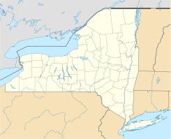
Ubicación en el condado de Suffolk y en el estado de Nueva York
40°59′41″N 72°32′14″O / 40.99472, -72.53722Coordenadas: 40°59′41″N 72°32′14″O / 40.99472, -72.53722
Entidad Lugar designado por el censo
 • País Bandera de los Estados Unidos Estados Unidos
 • Estado Flag of New York.svg Nueva York
 • Condado Suffolk
 • Pueblo Southold
Superficie  
 • Total 26,5 km²
 • Tierra 22,4 km²
 • Agua (15,53%) 4,1 km²
Altitud  
 • Media 4 msnm
Población (2000)  
 • Total 4.198 hab.
 • Densidad 187.5 hab/km²
Huso horario Este: UTC-5
 • en verano UTC-4
Código postal 11952
Prefijo telefónico 631

Mattituck es un lugar designado por el censo (o aldea) ubicado en el condado de Suffolk en el estado estadounidense de Nueva York. En el año 2000 tenía una población de 4.198 habitantes y una densidad poblacional de 187.5 personas por km².

Contenido

Geografía

Mattituck se encuentra ubicado en las coordenadas 40°59′41″N 72°32′14″O / 40.99472, -72.53722. Según la Oficina del Censo, la ciudad tiene un área total de 26,5 km² (10,2 mi²), de la cual 22,4 km² (8,6 mi²) es tierra y 4,1 km² (1,6 mi²) (15.53%) es agua.

Demografía

Según la Oficina del Censo en 2000 los ingresos medios por hogar en la localidad eran de $55,353, y los ingresos medios por familia eran $63,370. Los hombres tenían unos ingresos medios de $42,917 frente a los $34,813 para las mujeres. La renta per cápita de la localidad era de $26,101. Alrededor del 5.6% de la población estaban por debajo del umbral de pobreza.[1]

Referencias

  1. «U.S. Gazetteer: Censo de 2010» (en inglés). Oficina del Censo de los Estados Unidos (16 de febrero de 2011). Consultado el 11 de julio de 2011.

Enlaces externos


Wikimedia foundation. 2010.

Игры ⚽ Нужно сделать НИР?

Mira otros diccionarios:

  • Mattituck — Mattituck, NY U.S. Census Designated Place in New York Population (2000): 4198 Housing Units (2000): 2313 Land area (2000): 8.642859 sq. miles (22.384902 sq. km) Water area (2000): 1.593108 sq. miles (4.126131 sq. km) Total area (2000): 10.235967 …   StarDict's U.S. Gazetteer Places

  • Mattituck, NY — U.S. Census Designated Place in New York Population (2000): 4198 Housing Units (2000): 2313 Land area (2000): 8.642859 sq. miles (22.384902 sq. km) Water area (2000): 1.593108 sq. miles (4.126131 sq. km) Total area (2000): 10.235967 sq. miles (26 …   StarDict's U.S. Gazetteer Places

  • Mattituck — Original name in latin Mattituck Name in other language State code US Continent/City America/New York longitude 40.99121 latitude 72.53425 altitude 12 Population 4219 Date 2011 05 14 …   Cities with a population over 1000 database

  • Mattituck, New York — Mattituck   CDP   Mattituck Inlet …   Wikipedia

  • Mattituck-Cutchogue Union Free School District — Established early 1970s[1] Type Public Superintendent James F. McKenna Location …   Wikipedia

  • Mattituck (LIRR station) — Mattituck Platform as seen in January 2010 Station statistics …   Wikipedia

  • Mattituck Airport — IATA: none – ICAO: none – FAA LID: 21N Summary Airport type Public Owner J. Parker Wickham Serves …   Wikipedia

  • 11952 — Mattituck, Ny (Miscellaneous » ZIP Codes) …   Abbreviations dictionary

  • Andrew Gildersleeve Octagonal Building — Infobox nrhp | name =Andrew Gildersleeve Octagonal Building nrhp type = caption = location= Main Rd. and Love Lane, Mattituck, New York lat degrees = 40 lat minutes = 59 lat seconds = 28 lat direction = N long degrees = 72 long minutes = 31 long… …   Wikipedia

  • List of county routes in Suffolk County, New York (76–100) — The following is a list of county routes in Suffolk County, New York from Routes 76 to 100. Contents 1 County Route 76 1.1 Major intersections 2 County Route 77 2.1 Route description …   Wikipedia

Compartir el artículo y extractos

Link directo
Do a right-click on the link above
and select “Copy Link”