- Nettleden with Potten End
-
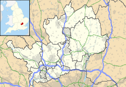
Nettleden with Potten End Parroquia civil del Reino Unido Ubicación de Nettleden with Potten End en Hertfordshire. Coordenadas: Entidad Parroquia civil • País  Reino Unido
• Nación constitutiva Inglaterra • Región Este de Inglaterra • Condado Hertfordshire • Distrito Dacorum Superficie • Total 7,08 km² Población (2001) • Total 1.526 hab. • Densidad 215,54 hab/km² Huso horario GMT (UTC0) • en verano BST (UTC +1) Nettleden with Potten End es una parroquia civil del distrito de Dacorum, en el condado de Hertfordshire (Inglaterra).
Geografía
Según la Oficina Nacional de Estadística británica, Nettleden with Potten End tiene una superficie de 7,08 km².[1]
Demografía
Según el censo de 2001, Nettleden with Potten End tenía 1526 habitantes (50,07% varones, 49,93% mujeres) y una densidad de población de 215,54 hab/km². El 19,59% eran menores de 16 años, el 72,21% tenían entre 16 y 74, y el 8,19% eran mayores de 74. La media de edad era de 41,84 años. Del total de habitantes con 16 o más años, el 17,11% estaban solteros, el 71,39% casados, y el 11,49% divorciados o viudos.[2]
El 92,47% de los habitantes eran originarios del Reino Unido. El resto de países europeos englobaban al 2,42% de la población, mientras que el 5,11% había nacido en cualquier otro lugar. Según su grupo étnico, el 97,97% eran blancos, el 0,65% mestizos, el 0,46% asiáticos, el 0,2% negros, el 0,2% chinos, y el 0,52% de cualquier otro. El cristianismo era profesado por el 77,01%, el budismo por el 0,26%, el hinduismo por el 0,59%, el judaísmo por el 0,59%, y cualquier otra religión, salvo el islam y el sijismo, por el 0,2%. El 14,93% no eran religiosos y el 6,42% no marcaron ninguna opción en el censo.[1]
Había 597 hogares con residentes y 30 vacíos.[2]
Referencias
- ↑ a b Tablas: «Usual Resident Population (KS01) for Amalgamated Parishes», «Ethnic Group (KS06) for Amalgamated Parishes», «Country of Birth (KS05) for Amalgamated Parishes» y «Religion (KS07) for Amalgamated Parishes», disponibles para descarga aquí. Office for National Statistics (inglés).
- ↑ a b «Area: Nettleden with Potten End CP (Parish)» (en inglés). Office for National Statistics. Consultado el 26 de octubre de 2011.
Wikimedia foundation. 2010.

