Sergeant Bluff (Iowa)

Sergeant Bluff (Iowa)
Sergeant Bluff
Ciudad de los Estados Unidos
Sergeant Bluff
Sergeant Bluff
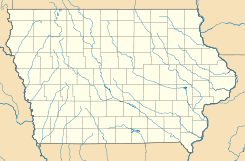
Ubicación en el condado de Woodbury en Iowa
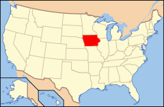
Ubicación de Iowa en EE. UU.
42°23′58″N 96°21′18″O / 42.39944, -96.355Coordenadas: 42°23′58″N 96°21′18″O / 42.39944, -96.355
Entidad Ciudad
 • País Bandera de los Estados Unidos Estados Unidos
 • Estado Bandera de Iowa Iowa
 • Condado Woodbury
Superficie  
 • Total 5,46 km²
 • Tierra 5,46 km²
 • Agua (0%) 0 km²
Altitud  
 • Media 334 msnm
Población (2010)  
 • Total 4.227 hab.
 • Densidad 773,49 hab/km²
Huso horario Centro: UTC-6
 • en verano UTC-5
GNIS 2396575[1]

Sergeant Bluff es una ciudad ubicada en el condado de Woodbury en el estado estadounidense de Iowa. En el Censo de 2010 tenía una población de 4227 habitantes y una densidad poblacional de 773,49 personas por km².[2]

Contenido

Geografía

Sergeant Bluff se encuentra ubicada en las coordenadas 42°23′58″N 96°21′18″O / 42.39944, -96.355. Según la Oficina del Censo de los Estados Unidos, Sergeant Bluff tiene una superficie total de 5.46 km², de la cual 5.46 km² corresponden a tierra firme y (0%) 0 km² es agua.[3]

Demografía

Según el censo de 2010,[4] había 4227 personas residiendo en Sergeant Bluff. La densidad de población era de 773,49 hab./km². De los 4227 habitantes, Sergeant Bluff estaba compuesto por el 93.09% blancos, el 1.06% eran afroamericanos, el 0.78% eran amerindios, el 2.13% eran asiáticos, el 0% eran isleños del Pacífico, el 0.99% eran de otras razas y el 1.94% pertenecían a dos o más razas. Del total de la población el 3.34% eran hispanos o latinos de cualquier raza.[5]

Referencias

  1. «Sistema de Información de Nombres Geográficos: Sergeant Bluff (Iowa)». Geographic Names Information System (en inglés) Consultado el 21 de noviembre de 2011.
  2. «U.S. Gazetteer: Censo de 2010» (en inglés). Oficina del Censo de los Estados Unidos (16 de febrero de 2011). Consultado el 11 de julio de 2011.
  3. «Encuentra un condado» (en inglés). Asociación Nacional de Condados (11 de julio de 2011). Consultado el 11 de julio de 2011.
  4. «American FactFinder» (en inglés). Oficina del Censo de los Estados Unidos. Consultado el 11 de julio de 2011.
  5. «US Board on Geographic Names» (en inglés). Servicio Geológico de los Estados Unidos (25 de octubre de 2007). Consultado el 11 de julio de 2011.

Enlaces externos


Wikimedia foundation. 2010.

Игры ⚽ Поможем написать курсовую

Mira otros diccionarios:

  • Sergeant Bluff, Iowa — Infobox Settlement official name = Sergeant Bluff, Iowa settlement type = City nickname = motto = imagesize = image caption = image imagesize = image caption = image mapsize = 250px map caption = Location of Sergeant Bluff, Iowa mapsize1 = map… …   Wikipedia

  • Sergeant Bluff-Luton School District — The Sergeant Bluff Luton School District is a public school system located in Sergeant Bluff, Iowa. The school provides education for students living in Sergeant Bluff, as well as students living in Luton, Iowa.choolsPrimary schoolLocated on 206… …   Wikipedia

  • Sergeant Bluff — Sergeant Bluff, IA U.S. city in Iowa Population (2000): 3321 Housing Units (2000): 1176 Land area (2000): 1.990221 sq. miles (5.154649 sq. km) Water area (2000): 0.000000 sq. miles (0.000000 sq. km) Total area (2000): 1.990221 sq. miles (5.154649 …   StarDict's U.S. Gazetteer Places

  • Sergeant Bluff, IA — U.S. city in Iowa Population (2000): 3321 Housing Units (2000): 1176 Land area (2000): 1.990221 sq. miles (5.154649 sq. km) Water area (2000): 0.000000 sq. miles (0.000000 sq. km) Total area (2000): 1.990221 sq. miles (5.154649 sq. km) FIPS code …   StarDict's U.S. Gazetteer Places

  • Iowa District West (LCMS) — The Iowa District West is one of the 35 districts of the Lutheran Church Missouri Synod (LCMS), and covers the western half of the state of Iowa including the state capital, Des Moines; the rest of the state forms the Iowa District East. The Iowa …   Wikipedia

  • History of Sioux City, Iowa — Early historyThe region that would become Sioux City was inhabited by the ancestors of Native Americans for thousands of years. Europeans first came into contact with the native people during the eighteenth century, when Spanish and French… …   Wikipedia

  • Sergeant Floyd Monument — Infobox nrhp | name =Sergeant Floyd Monument nrhp type =nhl caption = Sergeant Floyd Monument, Sioux City, Iowa location= Glenn Ave. and Lewis Rd., Sioux City, Iowa lat degrees = 42 lat minutes = 27 lat seconds = 45.25 lat direction = N long… …   Wikipedia

  • Sioux City, Iowa — Infobox Settlement official name = City of Sioux City settlement type = City nickname = motto = Successful Surprising Sioux City imagesize = image caption = image imagesize = image caption = image mapsize = 250px map caption = Location in Iowa… …   Wikipedia

  • List of high schools in Iowa — This is a list of high schools in the state of Iowa. You can also see a list of school districts in Iowa.Adair County*Nodaway Valley Community School District **Nodaway Valley High School, GreenfieldAdams County*Corning High School,… …   Wikipedia

  • Woodbury County, Iowa — Infobox U.S. County county = Woodbury County state = Iowa map size = 225 founded = 1851 seat = Sioux City | area total sq mi =877 area land sq mi =873 area water sq mi =5 area percentage = 0.55% census yr = 2000 pop = 103877 density km2 =46 web …   Wikipedia

Compartir el artículo y extractos

Link directo
Do a right-click on the link above
and select “Copy Link”