Shelter Island Heights

Shelter Island Heights
Shelter Island
Lugar designado por el censo de los Estados Unidos
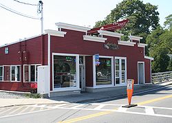
ShelterIslandHeights.jpg

Una calle de Shelter Island
Shelter Island
Shelter Island
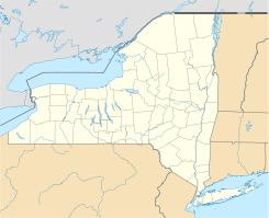
Ubicación en el condado de Suffolk y en el estado de Nueva York
41°4′41″N 72°21′3″O / 41.07806, -72.35083Coordenadas: 41°4′41″N 72°21′3″O / 41.07806, -72.35083
Entidad Lugar designado por el censo
 • País Bandera de los Estados Unidos Estados Unidos
 • Estado Flag of New York.svg Nueva York
 • Condado Suffolk
 • Pueblo Shelter Island
Superficie  
 • Total 14,6 km²
 • Tierra 13,9 km²
 • Agua (4,97%) 0,7 km²
Altitud  
 • Media 17 msnm
Población (2000)  
 • Total 981 hab.
 • Densidad 70.7 hab/km²
Huso horario Este: UTC-5
 • en verano UTC-4
Código postal 11964
Prefijo telefónico 631

Shelter Island es un lugar designado por el censo (o aldea) ubicado en el condado de Suffolk en el estado estadounidense de Nueva York. En el año 2000 tenía una población de 981 habitantes y una densidad poblacional de 70.7 personas por km².

Contenido

Geografía

Shelter Island se encuentra ubicado en las coordenadas 41°4′41″N 72°21′3″O / 41.07806, -72.35083. Según la Oficina del Censo, la ciudad tiene un área total de 14,6 km² (5,6 mi²), de la cual 13,9 km² (5,4 mi²) es tierra y 0,7 km² (0,3 mi²) (4.97%) es agua.

Demografía

Según la Oficina del Censo en 2000 los ingresos medios por hogar en la localidad eran de $65,446, y los ingresos medios por familia eran $76,162. Los hombres tenían unos ingresos medios de $46,750 frente a los $37,955 para las mujeres. La renta per cápita de la localidad era de $34,083. Alrededor del 6.2% de la población estaban por debajo del umbral de pobreza.[1]

Referencias

  1. «U.S. Gazetteer: Censo de 2010» (en inglés). Oficina del Censo de los Estados Unidos (16 de febrero de 2011). Consultado el 11 de julio de 2011.

Enlaces externos


Wikimedia foundation. 2010.

Игры ⚽ Поможем сделать НИР

Mira otros diccionarios:

  • Shelter Island Heights — Shelter Island Heights, NY U.S. Census Designated Place in New York Population (2000): 981 Housing Units (2000): 1374 Land area (2000): 5.357088 sq. miles (13.874793 sq. km) Water area (2000): 0.277496 sq. miles (0.718712 sq. km) Total area… …   StarDict's U.S. Gazetteer Places

  • Shelter Island Heights, NY — U.S. Census Designated Place in New York Population (2000): 981 Housing Units (2000): 1374 Land area (2000): 5.357088 sq. miles (13.874793 sq. km) Water area (2000): 0.277496 sq. miles (0.718712 sq. km) Total area (2000): 5.634584 sq. miles… …   StarDict's U.S. Gazetteer Places

  • Shelter Island Heights — Original name in latin Shelter Island Heights Name in other language State code US Continent/City America/New York longitude 41.08399 latitude 72.35592 altitude 24 Population 1048 Date 2011 05 14 …   Cities with a population over 1000 database

  • Shelter Island Heights, New York — Infobox Settlement official name = Shelter Island Heights, New York settlement type = CDP nickname = motto = imagesize = image caption = image mapsize = 250x200px map caption = pushpin mapsize1 = map caption1 = subdivision type = Country… …   Wikipedia

  • Shelter Island — Shelter Island …   Deutsch Wikipedia

  • Shelter Island — may refer to:Places: *Shelter Island (town), New York, which encompasses two hamlets with similar names: **Shelter Island (CDP), New York (census designated place) **Shelter Island Heights, New York *Shelter Island Sound, a New York sound… …   Wikipedia

  • Shelter Island (town), New York — Infobox Settlement official name = Shelter Island, New York settlement type = Town nickname = motto = imagesize = 250px image caption = image mapsize = 250px map caption = pushpin mapsize1 = map caption1 = subdivision type = Country subdivision… …   Wikipedia

  • National Register of Historic Places listings in Shelter Island (town), New York — This is a List of the National Register of Historic Places listings on Shelter, New York Map of all coordinates from Google Map of all coordinates from Bing …   Wikipedia

  • List of Long Island public school districts and schools — Long Island s Nassau and Suffolk counties are home to 125 school districts containing a total of 656 public schools. **Please add a School District number if it is known to you**Amagansett Union Free School DistrictAmagansett School Amityville… …   Wikipedia

  • Music of Long Island — Part of the article series on Main article Topics Geography History Economy Transportation Politics Music People Popular culture …   Wikipedia

Compartir el artículo y extractos

Link directo
Do a right-click on the link above
and select “Copy Link”