- Shepherdsville (Kentucky)
-
Shepherdsville Ciudad de los Estados Unidos Ubicación en el condado de Bullitt en Kentucky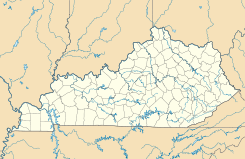
 Shepherdsville
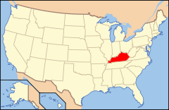
Ubicación de Kentucky en EE. UU.Coordenadas: Entidad Ciudad • País  Estados Unidos
• Estado  Kentucky
• Condado Bullitt Superficie • Total 25,83 km² • Tierra 25,05 km² • Agua (3,01%) 0,78 km² Altitud • Media 135 msnm Población (2010) • Total 11.222 hab. • Densidad 434,46 hab/km² Huso horario Este: UTC-5 • en verano UTC-4 GNIS 2405458[1] Shepherdsville es una ciudad ubicada en el condado de Bullitt en el estado estadounidense de Kentucky. En el Censo de 2010 tenía una población de 11222 habitantes y una densidad poblacional de 434,46 personas por km².[2]
Contenido
Geografía
Shepherdsville se encuentra ubicada en las coordenadas . Según la Oficina del Censo de los Estados Unidos, Shepherdsville tiene una superficie total de 25.83 km², de la cual 25.05 km² corresponden a tierra firme y (3.01%) 0.78 km² es agua.[3]
Demografía
Según el censo de 2010,[4] había 11222 personas residiendo en Shepherdsville. La densidad de población era de 434,46 hab./km². De los 11222 habitantes, Shepherdsville estaba compuesto por el 95.83% blancos, el 0.99% eran afroamericanos, el 0.37% eran amerindios, el 0.55% eran asiáticos, el 0.03% eran isleños del Pacífico, el 0.6% eran de otras razas y el 1.64% pertenecían a dos o más razas. Del total de la población el 1.6% eran hispanos o latinos de cualquier raza.[5]
Referencias
- ↑ «Sistema de Información de Nombres Geográficos: Shepherdsville (Kentucky)». Geographic Names Information System (en inglés) Consultado el 16 de noviembre de 2011.
- ↑ «U.S. Gazetteer: Censo de 2010» (en inglés). Oficina del Censo de los Estados Unidos (16 de febrero de 2011). Consultado el 11 de julio de 2011.
- ↑ «Encuentra un condado» (en inglés). Asociación Nacional de Condados (11 de julio de 2011). Consultado el 11 de julio de 2011.
- ↑ «American FactFinder» (en inglés). Oficina del Censo de los Estados Unidos. Consultado el 11 de julio de 2011.
- ↑ «US Board on Geographic Names» (en inglés). Servicio Geológico de los Estados Unidos (25 de octubre de 2007). Consultado el 11 de julio de 2011.
Enlaces externos
 Portal:Kentucky. Contenido relacionado con Kentucky.
 Wikimedia Commons alberga contenido multimedia sobre Shepherdsville (Kentucky). Commons
Categorías:- Ciudades de Kentucky
- Localidades del condado de Bullitt


Wikimedia foundation. 2010.