Snowville (Utah)

Snowville (Utah)
Snowville
Pueblo de los Estados Unidos
Snowville
Snowville
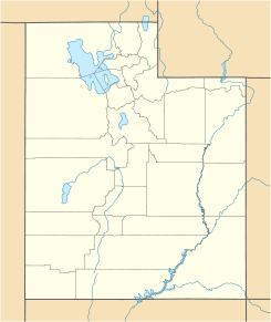
Ubicación en el condado de Box Elder en Utah
Map of USA UT.svg
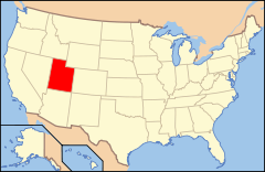
Ubicación de Utah en EE. UU.
41°58′14″N 112°42′33″O / 41.97056, -112.70917Coordenadas: 41°58′14″N 112°42′33″O / 41.97056, -112.70917
Entidad Pueblo
 • País Bandera de los Estados Unidos Estados Unidos
 • Estado Bandera de Utah Utah
 • Condado Box Elder
Superficie  
 • Total 4.0 km²
 • Tierra 4.0 km²
 • Agua (0%) km²
Altitud  
 • Media 1.386 msnm
Población (2000)  
 • Total 177 hab.
 • Densidad 44,6 hab/km²
Huso horario MST: UTC-6
 • en verano UTC-7
Código ZIP 84336
Código de área 435

Snowville es un pueblo ubicado en el condado de Box Elder en el estado estadounidense de Utah. En el año 2000 tenía una población de 177 habitantes.

Contenido

Geografía

Snowville se encuentra ubicado en las coordenadas 41°58′14″N 112°42′33″O / 41.97056, -112.70917Coordenadas: 41°58′14″N 112°42′33″O / 41.97056, -112.70917. Según la Oficina del Censo, la localidad tiene un área total de 4,0 km² (1,5 mi²), de la cual toda es tierra.[1]

Demografía

Según la Oficina del Censo en 2000,[2] habían 177 personas y 46 familias residentes en el lugar, 88.7% de los cuales eran personas de raza blanca.

Según la Oficina del Censo en 2000 los ingresos medios por hogar en la localidad eran de $24,375, y los ingresos medios por familia eran $35,750. Los hombres tenían unos ingresos medios de $36,250 frente a los $35,250 para las mujeres. La renta per cápita para la localidad era de $13,604. Alrededor del 4.8% de la población estaban por debajo del umbral de pobreza, incluyendo más de la mitad de los habitantes mayores de 65 años.[2]

Referencias

  1. «U.S. Gazetteer: Censo de 2010» (en inglés). Oficina del Censo de los Estados Unidos (16 de febrero de 2011). Consultado el 11 de julio de 2011.
  2. a b «American FactFinder» (en inglés). Oficina del Censo de los Estados Unidos. Consultado el 11 de julio de 2011.

Enlaces externos


Wikimedia foundation. 2010.

Игры ⚽ Нужно сделать НИР?

Mira otros diccionarios:

  • Snowville, Utah — Infobox Settlement official name = Snowville, Utah settlement type = Town nickname = motto = imagesize = image caption = image mapsize = 250px map caption = Location of Snowville, Utah mapsize1 = map caption1 = subdivision type = Country… …   Wikipedia

  • Snowville — may refer to: *Snowville, Utah *Snowville, New Hampshire …   Wikipedia

  • Utah locations by per capita income — See also: List of cities in Utah Utah has the thirty ninth highest per capita income in the United States of America, at $18,185 (2000). Its personal per capita income is $24,977 (2003). Utah counties ranked by per capita income There are twenty… …   Wikipedia

  • Snowville — Snowville, UT U.S. town in Utah Population (2000): 177 Housing Units (2000): 71 Land area (2000): 1.533536 sq. miles (3.971839 sq. km) Water area (2000): 0.000000 sq. miles (0.000000 sq. km) Total area (2000): 1.533536 sq. miles (3.971839 sq. km) …   StarDict's U.S. Gazetteer Places

  • Snowville, UT — U.S. town in Utah Population (2000): 177 Housing Units (2000): 71 Land area (2000): 1.533536 sq. miles (3.971839 sq. km) Water area (2000): 0.000000 sq. miles (0.000000 sq. km) Total area (2000): 1.533536 sq. miles (3.971839 sq. km) FIPS code:… …   StarDict's U.S. Gazetteer Places

  • Utah State Route 30 — Infobox road state=UT type=SR route=30 alternate name=Bear Lake Scenic Byway Valley View Highway section=108 maint= length mi=135.620 length round=3 length ref=cite web url=http://www.dot.utah.gov/main/uconowner.gf?n=7043101423294856 title=Route… …   Wikipedia

  • Utah State Route 42 — Infobox road state=UT type=SR route=42 section=110 maint=UDOT length mi=7.390 length round=3 length ref=cite web | title=State Route 42 Highway reference | publisher=Utah Department of Transportation |… …   Wikipedia

  • Utah — This article is about the U.S. state of Utah. For other uses, see Utah (disambiguation). State of Utah …   Wikipedia

  • Interstate 84 in Utah — Infobox road state=UT type=I route=84 section=114 maint= length mi=119.77 length round=2 length ref= established= direction a=West terminus a=jct|state=ID|I|84 at the Idaho state line near Snowville junction=jct|state=UT|I|15 near Tremonton… …   Wikipedia

  • Box Elder County, Utah — Infobox U.S. County county = Box Elder County state = Utah seal seallink map size = 300 founded year = 1856 seat wl = Brigham City largest cities wl = Brigham City, Tremonton, Perry area total sq mi = 6714 area total km2 = 17428 area land sq mi …   Wikipedia

Compartir el artículo y extractos

Link directo
Do a right-click on the link above
and select “Copy Link”