Virgie (Kentucky)

Virgie (Kentucky)
Virgie
Lugar designado por el censo de los Estados Unidos
Virgie
Virgie
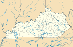
Ubicación en el condado de Pike en Kentucky
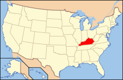
Ubicación de Kentucky en EE. UU.
37°19′56″N 82°34′57″O / 37.33222, -82.5825Coordenadas: 37°19′56″N 82°34′57″O / 37.33222, -82.5825
Entidad Lugar designado por el censo
 • País Bandera de los Estados Unidos Estados Unidos
 • Estado Bandera de Kentucky Kentucky
 • Condado Pike
Superficie  
 • Total 2,65 km²
 • Tierra 2,65 km²
 • Agua (0%) 0 km²
Altitud  
 • Media 251 msnm
Población (2010)  
 • Total 279 hab.
 • Densidad 105,2 hab/km²
Huso horario Este: UTC-5
 • en verano UTC-4
GNIS 2629700[1]

Virgie es un lugar designado por el censo ubicado en el condado de Pike en el estado estadounidense de Kentucky. En el Censo de 2010 tenía una población de 279 habitantes y una densidad poblacional de 105,2 personas por km².[2]

Contenido

Geografía

Virgie se encuentra ubicado en las coordenadas 37°19′56″N 82°34′57″O / 37.33222, -82.5825. Según la Oficina del Censo de los Estados Unidos, Virgie tiene una superficie total de 2.65 km², de la cual 2.65 km² corresponden a tierra firme y (0%) 0 km² es agua.[3]

Demografía

Según el censo de 2010,[4] había 279 personas residiendo en Virgie. La densidad de población era de 105,2 hab./km². De los 279 habitantes, Virgie estaba compuesto por el 100% blancos, el 0% eran afroamericanos, el 0% eran amerindios, el 0% eran asiáticos, el 0% eran isleños del Pacífico, el 0% eran de otras razas y el 0% pertenecían a dos o más razas. Del total de la población el 0.72% eran hispanos o latinos de cualquier raza.[5]

Referencias

  1. «Sistema de Información de Nombres Geográficos: Virgie (Kentucky)». Geographic Names Information System (en inglés) Consultado el 22 de noviembre de 2011.
  2. «U.S. Gazetteer: Censo de 2010» (en inglés). Oficina del Censo de los Estados Unidos (16 de febrero de 2011). Consultado el 11 de julio de 2011.
  3. «Encuentra un condado» (en inglés). Asociación Nacional de Condados (11 de julio de 2011). Consultado el 11 de julio de 2011.
  4. «American FactFinder» (en inglés). Oficina del Censo de los Estados Unidos. Consultado el 11 de julio de 2011.
  5. «US Board on Geographic Names» (en inglés). Servicio Geológico de los Estados Unidos (25 de octubre de 2007). Consultado el 11 de julio de 2011.

Enlaces externos

  • Ver el portal sobre Kentucky Portal:Kentucky. Contenido relacionado con Kentucky.

Wikimedia foundation. 2010.

Игры ⚽ Поможем написать реферат

Mira otros diccionarios:

  • Virgie, Kentucky — Virgie is an unincorporated community in Pike County, Kentucky, United States. Located along Kentucky Route 1469, it lies at 37.335ºN, 82.579ºW at the altitude of 902 feet.GR|1There are two schools in Virgie: *George F Johnson Elementary School… …   Wikipedia

  • Virgie — may refer to:*Virgie, Indiana *Virgie, Kentucky …   Wikipedia

  • U.S. Route 23 in Kentucky — Infobox road state=KY type=US route=23 length mi= length ref=fact length round=3 established=late 1920s direction a=South direction b=North starting terminus= junction= ending terminus= previous type= previous route=22 next type=Interstate next… …   Wikipedia

  • Coal Run Village, Kentucky —   City   Location of Coal Run Village, Kentucky …   Wikipedia

  • Miss Kentucky Teen USA — The Miss Kentucky Teen USA competition is the pageant that selects the representative for the state of Kentucky in the Miss Teen USA pageant. Kentucky is ranked eight in terms of place and value of placements across all twenty three years of… …   Wikipedia

  • Condado de Pike (Kentucky) — Para otros usos de este término, véase Condado de Pike. Condado de Pike Condado de los Estados Unidos …   Wikipedia Español

  • Pike County, Kentucky — Infobox U.S. County county = Pike County state = Kentucky founded year = 1822 founded date = seat wl = Pikeville largest city wl = area total sq mi = 789 area total km2 = 2043 area land sq mi = 788 area land km2 = 2040 area water sq mi = 1 area… …   Wikipedia

  • East Kentucky Broadcasting — is a network of radio stations serving the Eastern Kentucky area. Current stations HistoryOn December 23, 1948, articles of incorporation were drafted to create a new radio station in Pikeville, Kentucky. This radio station became WPKE AM. July… …   Wikipedia

  • National Register of Historic Places listings in Pike County, Kentucky — Location of Pike County in Kentucky This is a list of the National Register of Historic Places listings in Pike County, Kentucky. It is intended to be a complete list of the properties and districts on the National Register of Historic Places in… …   Wikipedia

  • Dorton, Kentucky — Dorton is an unincorporated community in southern Pike County, Kentucky, United States. Located along U.S. Route 23, also known as Country Music Highway, it lies at 37.27667°N, 82.57917°W at the altitude of 683 feet.It is centered at the… …   Wikipedia

Compartir el artículo y extractos

Link directo
Do a right-click on the link above
and select “Copy Link”