Westphalia (Maryland)

Westphalia (Maryland)
Westphalia
Lugar designado por el censo de los Estados Unidos
Westphalia
Westphalia
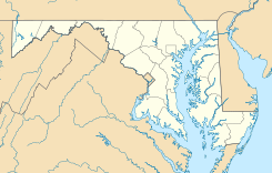
Ubicación en el condado de Prince George en Maryland
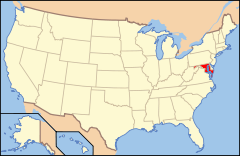
Ubicación de Maryland en EE. UU.
38°50′25″N 76°49′27″O / 38.84028, -76.82417Coordenadas: 38°50′25″N 76°49′27″O / 38.84028, -76.82417
Entidad Lugar designado por el censo
 • País Bandera de los Estados Unidos Estados Unidos
 • Estado Bandera de Maryland Maryland
 • Condado Prince George
Superficie  
 • Total 34,44 km²
 • Tierra 34,37 km²
 • Agua (0,2%) 0,07 km²
Altitud  
 • Media 56 msnm
Población (2010)  
 • Total 7,266 hab.
 • Densidad 210,97 hab/km²
Huso horario Este: UTC-5
 • en verano UTC-4
GNIS 2583702[1]

Westphalia es un lugar designado por el censo ubicado en el condado de Prince George en el estado estadounidense de Maryland. En el Censo de 2010 tenía una población de 7.266 habitantes y una densidad poblacional de 210,97 personas por km².[2]

Contenido

Geografía

Westphalia se encuentra ubicado en las coordenadas 38°50′25″N 76°49′27″O / 38.84028, -76.82417. Según la Oficina del Censo de los Estados Unidos, Westphalia tiene una superficie total de 34.44 km², de la cual 34.37 km² corresponden a tierra firme y (0.2%) 0.07 km² es agua.[3]

Demografía

Según el censo de 2010,[4] había 7.266 personas residiendo en Westphalia. La densidad de población era de 210,97 hab./km². De los 7.266 habitantes, Westphalia estaba compuesto por el 11.05% blancos, el 83.22% eran afroamericanos, el 0.4% eran amerindios, el 0.99% eran asiáticos, el 0% eran isleños del Pacífico, el 1.61% eran de otras razas y el 2.73% pertenecían a dos o más razas. Del total de la población el 3.59% eran hispanos o latinos de cualquier raza.[5]

Referencias

  1. «Sistema de Información de Nombres Geográficos: Westphalia (Maryland)». Geographic Names Information System (en inglés) Consultado el 22 de noviembre de 2011.
  2. «U.S. Gazetteer: Censo de 2010» (en inglés). Oficina del Censo de los Estados Unidos (16 de febrero de 2011). Consultado el 11 de julio de 2011.
  3. «Encuentra un condado» (en inglés). Asociación Nacional de Condados (11 de julio de 2011). Consultado el 11 de julio de 2011.
  4. «American FactFinder» (en inglés). Oficina del Censo de los Estados Unidos. Consultado el 11 de julio de 2011.
  5. «US Board on Geographic Names» (en inglés). Servicio Geológico de los Estados Unidos (25 de octubre de 2007). Consultado el 11 de julio de 2011.

Enlaces externos


Wikimedia foundation. 2010.

Игры ⚽ Нужно решить контрольную?

Mira otros diccionarios:

  • Maryland Route 4 — St. Andrew s Church Road, Patuxent Beach Road, Solomons Island Road, Southern Maryland Boulevard, Pennsylvania Avenue …   Wikipedia

  • Greater Upper Marlboro, Maryland — Infobox Settlement official name = Greater Upper Marlboro, Maryland settlement type = CDP nickname = motto = imagesize = image caption = image imagesize = image caption = image mapsize = map caption = mapsize1 = map caption1 = subdivision type =… …   Wikipedia

  • List of horse racing venues — This is a list of horse racing venues, sorted by country. In the United States they are usually called horse racing tracks, and in most other English speaking countries they are usually called racecourses. In many non English speaking countries… …   Wikipedia

  • List of United States towns with the same name as subnational regions — The following is a partial list of cities, towns, and villages in the United States that share names with subnational regions in the United States or worldwide: tates of the United States*Alabama, New York *Alaska, Michigan *Arkansas, West… …   Wikipedia

  • Germans in the United States — • Includes all German speaking people, whether originally from Germany proper, Austria, Switzerland, or Luxemburg Catholic Encyclopedia. Kevin Knight. 2006. Germans in the United States     Germans in the United States …   Catholic encyclopedia

  • Jérôme Bonaparte — For other people named Jérôme Bonaparte, see Jérôme Bonaparte (disambiguation). Jérôme I King of Westphalia 1st Prince of Montfort A portrait of Jérôme Bonaparte by François Gérard …   Wikipedia

  • List of twin towns and sister cities in Germany — This is a list of twin towns and sister cities in Germany. *Aachen, North Rhine Westphalia Halifax, West Yorkshire, England; Arlington, Virginia, USA; Reims, France *Ahrensburg, Schleswig Holstein Esplugues de Llobregat, Spain *Alsfeld, Hesse,… …   Wikipedia

  • Osage County, Missouri — Location in the state of Missouri …   Wikipedia

  • Düren (district) — Düren   District   Country …   Wikipedia

  • Pre-1773 History of the Jesuits —     Society of Jesus, History of the (Before 1773)     † Catholic Encyclopedia ► History of the Jesuits Before the 1773 Suppression     Italy     The history of the Jesuits in Italy was generally very peaceful. The only serious disturbances were… …   Catholic encyclopedia

Compartir el artículo y extractos

Link directo
Do a right-click on the link above
and select “Copy Link”