Worthington Hills

Worthington Hills
Worthington Hills
Ciudad de los Estados Unidos
Worthington Hills
Worthington Hills
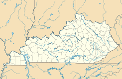
Ubicación en el condado de Jefferson en Kentucky
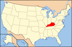
Ubicación de Kentucky en EE. UU.
38°18′34″N 85°31′37″O / 38.30944, -85.52694Coordenadas: 38°18′34″N 85°31′37″O / 38.30944, -85.52694
Entidad Ciudad
 • País Bandera de los Estados Unidos Estados Unidos
 • Estado Bandera de Kentucky Kentucky
 • Condado Jefferson
Superficie  
 • Total 0,64 km²
 • Tierra 0,64 km²
 • Agua (0%) 0 km²
Altitud  
 • Media 224 msnm
Población (2010)  
 • Total 1.446 hab.
 • Densidad 2.260,34 hab/km²
Huso horario Este: UTC-5
 • en verano UTC-4
GNIS 2405791[1]

Worthington Hills es una ciudad ubicada en el condado de Jefferson en el estado estadounidense de Kentucky. En el Censo de 2010 tenía una población de 1446 habitantes y una densidad poblacional de 2.260,34 personas por km².[2]

Contenido

Geografía

Worthington Hills se encuentra ubicada en las coordenadas 38°18′34″N 85°31′37″O / 38.30944, -85.52694. Según la Oficina del Censo de los Estados Unidos, Worthington Hills tiene una superficie total de 0.64 km², de la cual 0.64 km² corresponden a tierra firme y (0%) 0 km² es agua.[3]

Demografía

Según el censo de 2010,[4] había 1446 personas residiendo en Worthington Hills. La densidad de población era de 2.260,34 hab./km². De los 1446 habitantes, Worthington Hills estaba compuesto por el 62.52% blancos, el 29.46% eran afroamericanos, el 0.28% eran amerindios, el 3.04% eran asiáticos, el 0% eran isleños del Pacífico, el 0.76% eran de otras razas y el 3.94% pertenecían a dos o más razas. Del total de la población el 4.15% eran hispanos o latinos de cualquier raza.[5]

Referencias

  1. «Sistema de Información de Nombres Geográficos: Worthington Hills». Geographic Names Information System (en inglés) Consultado el 22 de noviembre de 2011.
  2. «U.S. Gazetteer: Censo de 2010» (en inglés). Oficina del Censo de los Estados Unidos (16 de febrero de 2011). Consultado el 11 de julio de 2011.
  3. «Encuentra un condado» (en inglés). Asociación Nacional de Condados (11 de julio de 2011). Consultado el 11 de julio de 2011.
  4. «American FactFinder» (en inglés). Oficina del Censo de los Estados Unidos. Consultado el 11 de julio de 2011.
  5. «US Board on Geographic Names» (en inglés). Servicio Geológico de los Estados Unidos (25 de octubre de 2007). Consultado el 11 de julio de 2011.

Enlaces externos


Wikimedia foundation. 2010.

Игры ⚽ Поможем сделать НИР

Mira otros diccionarios:

  • Worthington Hills — Worthington Hills, KY U.S. city in Kentucky Population (2000): 1594 Housing Units (2000): 589 Land area (2000): 0.279655 sq. miles (0.724303 sq. km) Water area (2000): 0.000000 sq. miles (0.000000 sq. km) Total area (2000): 0.279655 sq. miles… …   StarDict's U.S. Gazetteer Places

  • Worthington Hills, KY — U.S. city in Kentucky Population (2000): 1594 Housing Units (2000): 589 Land area (2000): 0.279655 sq. miles (0.724303 sq. km) Water area (2000): 0.000000 sq. miles (0.000000 sq. km) Total area (2000): 0.279655 sq. miles (0.724303 sq. km) FIPS… …   StarDict's U.S. Gazetteer Places

  • Worthington Hills — Original name in latin Worthington Hills Name in other language State code US Continent/City America/Kentucky/Louisville longitude 38.30896 latitude 85.5269 altitude 225 Population 1446 Date 2011 05 14 …   Cities with a population over 1000 database

  • Worthington Hills, Kentucky — Infobox Settlement official name = Worthington Hills, Kentucky settlement type = City nickname = motto = imagesize = image caption = image |pushpin pushpin label position =left pushpin map caption =Location within the state of Kentucky pushpin… …   Wikipedia

  • Worthington City School District — The Worthington City School district includes the City of Worthington, Village of Riverlea, and neighboring portions of the city of Columbus. There are approximately 50,000 people residing in the area. Because the district is essentially built… …   Wikipedia

  • Worthington, Ohio — Infobox Settlement official name = Worthington, Ohio settlement type = City nickname = motto = imagesize = image caption = image mapsize = 250px map caption = Location of Worthington within Ohio mapsize1 = 250px map caption1 = Location of… …   Wikipedia

  • Worthington Estates — Worthingon Estates is a large neighborhood in Worthington, Ohio, built mostly in the mid to late 1960 s. It is located north of the subdivision Worthingway, south of Olentangy Hills, and generally west of High Street (US 23) however, a small… …   Wikipedia

  • Douglass Hills, Kentucky —   City   …   Wikipedia

  • Druid Hills, Kentucky — For other uses, see Druid Hills (disambiguation). Druid Hills, Kentucky   City   …   Wikipedia

  • Colonial Hills (Subdivision of Worthington, Ohio) — Colonial Hills is a subdivision of 873 single family homes located in the city of Worthington, Ohio, a northern suburb of the state capital, Columbus. Built by the Defense Homes Corporation to meet the needs of World War II production and the… …   Wikipedia

Compartir el artículo y extractos

Link directo
Do a right-click on the link above
and select “Copy Link”