Cerniat

Cerniat

Cerniat

Cerniat
Escudo de Cerniat
Escudo
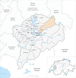
Karte Gemeinde Cerniat 2007.png
País Flag of Switzerland.svg Suiza
• Cantón Flag of Canton of Fribourg.svg Friburgo
• Distrito Gruyère
Ubicación 46°38′N 07°09′E / 46.633, 7.15
• Altitud 920 msnm
Superficie 33,78 km²
Población 349 hab. ((2006))
• Densidad 10 hab./km²
Lengua Francés
Código postal 1654

Cerniat (antiguamente en alemán Scherni) es una comuna suiza del cantón de Friburgo, situada en el distrito de Gruyère. Limita al norte con las comunas de Plasselb y Plaffeien, al este con Charmey, al sur con Crésuz y Châtel-sur-Montsalvens, y al oeste con Botterens, Villarvolard, Corbières, Hauteville y La Roche.

Personalidades

Obtenido de "Cerniat"

Wikimedia foundation. 2010.

Игры ⚽ Нужно сделать НИР?

Mira otros diccionarios:

  • Cerniat (FR) — Cerniat Basisdaten Kanton: Freiburg Bezirk: Gruyère …   Deutsch Wikipedia

  • Cerniat FR — Cerniat Basisdaten Kanton: Freiburg Bezirk: Gruyère …   Deutsch Wikipedia

  • Cerniat — Basisdaten Staat: Schweiz Kanton …   Deutsch Wikipedia

  • Cerniat —  Pour l’article homophone, voir Cerniaz. Cerniat Une vue d ensemble de la commune serait la bienvenue Administration Pays Suisse …   Wikipédia en Français

  • Cerniat — For the village in the canton of Vaud, see Cerniaz. Cerniat Country Switzerland …   Wikipedia

  • Scherni — Cerniat Basisdaten Kanton: Freiburg Bezirk: Gruyère …   Deutsch Wikipedia

  • Botteringen — Botterens Basisdaten Kanton: Freiburg Bezirk: Gruyère …   Deutsch Wikipedia

  • Kastels ob Montsalvens — Châtel sur Montsalvens Basisdaten Kanton: Freiburg Bezirk: Gruyère …   Deutsch Wikipedia

  • Korbers — FR dient als Kürzel für den Schweizer Kanton Freiburg und wird verwendet, um Verwechslungen mit anderen Einträgen des Namens Corbières zu vermeiden. Corbières …   Deutsch Wikipedia

  • Kürjü — Crésuz Basisdaten Kanton: Freiburg Bezirk: Gruyère …   Deutsch Wikipedia

Compartir el artículo y extractos

Link directo
Do a right-click on the link above
and select “Copy Link”