Randlett (Utah)

Randlett (Utah)

Randlett (Utah)

Randlett es un lugar designado por el censo (census-designated place o CDP) en el condado de Uintah, estado de Utah, Estados Unidos. Según el censo de 2000 la población era de 224 habitantes, con un ligero decremento repecto a 1990, cuando contaba con 283 habitantes.

Geografía

Localización de Randlett, Utah

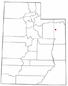
Randlett se encuentra en las coordenadas 40°14′2″N 109°49′21″O / 40.23389, -109.8225.

Según la oficina del censo de Estados Unidos, el CPD tiene una superficie total de 13,5 km². No tiene superficie cubierta de agua.

Obtenido de "Randlett (Utah)"

Wikimedia foundation. 2010.

Игры ⚽ Поможем сделать НИР

Mira otros diccionarios:

  • Randlett, Utah — Infobox Settlement official name = Randlett, Utah settlement type = CDP nickname = motto = imagesize = image caption = image mapsize = 250px map caption = Location of Randlett, Utah mapsize1 = map caption1 = subdivision type = Country subdivision …   Wikipedia

  • Randlett — may refer to: * Randlett, Utah * Randlett, Oklahoma …   Wikipedia

  • Utah locations by per capita income — See also: List of cities in Utah Utah has the thirty ninth highest per capita income in the United States of America, at $18,185 (2000). Its personal per capita income is $24,977 (2003). Utah counties ranked by per capita income There are twenty… …   Wikipedia

  • Randlett — Randlett, OK U.S. town in Oklahoma Population (2000): 511 Housing Units (2000): 210 Land area (2000): 0.630478 sq. miles (1.632930 sq. km) Water area (2000): 0.000000 sq. miles (0.000000 sq. km) Total area (2000): 0.630478 sq. miles (1.632930 sq …   StarDict's U.S. Gazetteer Places

  • Randlett, UT — U.S. Census Designated Place in Utah Population (2000): 224 Housing Units (2000): 74 Land area (2000): 5.208145 sq. miles (13.489033 sq. km) Water area (2000): 0.000000 sq. miles (0.000000 sq. km) Total area (2000): 5.208145 sq. miles (13.489033… …   StarDict's U.S. Gazetteer Places

  • Duchesne, Utah —   City   Looking down on Main Street …   Wikipedia

  • Dragon, Utah — Dragon   Ghost town   …   Wikipedia

  • National Register of Historic Places listings in Uintah County, Utah — Location of Uintah County in Utah This is a list of the National Register of Historic Places listings in Uintah County, Utah. This is intended to be a complete list of the properties and districts on the National Register of Historic Places in… …   Wikipedia

  • Maeser, Utah —   CDP   Welcome sign …   Wikipedia

  • Uintah County, Utah — Infobox U.S. County county = Uintah County state = Utah seal seallink map size = 150 founded year = 1880 seat wl = Vernal largest city wl = Vernal area total sq mi = 4499 area total km2 = 11652 area land sq mi = 4477 area land km2 = 11596 area… …   Wikipedia

Compartir el artículo y extractos

Link directo
Do a right-click on the link above
and select “Copy Link”