Villefranche-sur-Cher

Villefranche-sur-Cher
País Bandera de Francia Francia
• Región Centro
• Departamento Loir y Cher
• Distrito distrito de Romorantin-Lanthenay
• Cantón cantón de Mennetou-sur-Cher
• Mancomunidad Communauté de communes du Romorantinais
Ubicación 47°17′39″N 1°46′15″E / 47.2941666667, 1.77083333333Coordenadas: 47°17′39″N 1°46′15″E / 47.2941666667, 1.77083333333
• Altitud 98 msnm
(mín.: 82 m, máx.: 123 m)
Superficie 27,23 km²
Población 2.587 hab. (2006)
• Densidad 95,01 hab./km²
Gentilicio Francvillois (en francés)
Código postal 41200
Alcalde Joël AUGER
2001 - 2008
Código INSEE 41280
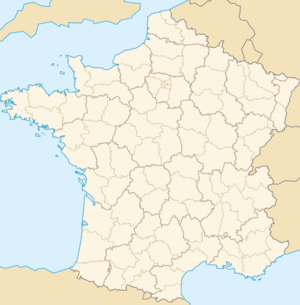
Ubicación de Villefranche-sur-Cher en Francia

Villefranche-sur-Cher es una población y comuna francesa, en la región de Centro, departamento de Loir y Cher, en el distrito de Romorantin-Lanthenay y cantón de Mennetou-sur-Cher.

Demografía

Datos de población
1962 1968 1975 1982 1990 1999 2006
1527 1540 1743 2055 2298 2409 2587
Para los censos de 1962 a 1999 la población legal corresponde a la población sin duplicidades, según define el INSEE.

Referencias

Traducción de fr:Villefranche-sur-Cher

Enlaces externos


Wikimedia foundation. 2010.

Игры ⚽ Поможем написать реферат

Mira otros diccionarios:

  • Villefranche-sur-cher — Pour les articles homonymes, voir Villefranche. Villefranche sur Cher …   Wikipédia en Français

  • Villefranche-sur-Cher — is a village and commune in the Loir et Cher département of northern central France.ee also*Communes of the Loir et Cher department …   Wikipedia

  • Villefranche-sur-Cher — Pour les articles homonymes, voir Villefranche. 47° 17′ 39″ N 1° 46′ 15″ E …   Wikipédia en Français

  • Villefranche-sur-Cher — Original name in latin Villefranche sur Cher Name in other language State code FR Continent/City Europe/Paris longitude 47.3 latitude 1.76667 altitude 99 Population 2553 Date 2007 11 20 …   Cities with a population over 1000 database

  • Gare de Villefranche-sur-Cher — Villefranche sur Cher Localisation Pays France Commune Villefranche sur Cher Coordonnées géographiques …   Wikipédia en Français

  • Ligne Villefranche-sur-Cher - Blois — Ligne Villefranche s/ C. Blois Pays  France Villes desservies Blois, Villefranche sur Cher, Romorantin Lanthenay …   Wikipédia en Français

  • Ligne de Villefranche-sur-Cher à Blois — Ligne Villefranche sur Cher Blois Pays  France Villes desservies Blois, Villefranche sur Cher, Romorantin Lanthenay …   Wikipédia en Français

  • Église Sainte-Marie-Madeleine de Villefranche-sur-Cher — Église Sainte Marie Madeleine Présentation Propriétaire Commune Protection  Classé MH (1986) Géographie …   Wikipédia en Français

  • Mennetou-sur-Cher — 47° 16′ 14″ N 1° 52′ 00″ E / 47.2705555556, 1.86666666667 …   Wikipédia en Français

  • Châtillon-sur-Cher — Châtillon sur Cher …   Wikipedia

Compartir el artículo y extractos

Link directo
Do a right-click on the link above
and select “Copy Link”