Litchfield (Nuevo Hampshire)

Litchfield (Nuevo Hampshire)
Litchfield
Pueblo de los Estados Unidos
Litchfield
Litchfield
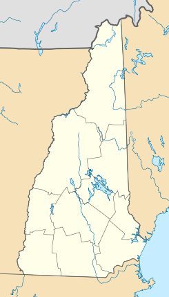
Ubicación en el condado de Hillsborough en Nuevo Hampshire
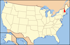
Ubicación de Nuevo Hampshire en EE. UU.
42°50′46″N 71°28′6″O / 42.84611, -71.46833Coordenadas: 42°50′46″N 71°28′6″O / 42.84611, -71.46833
Entidad Pueblo
 • País Bandera de los Estados Unidos Estados Unidos
 • Estado Flag of New Hampshire.svg Nuevo Hampshire
 • Condado Hillsborough
Fundación 1734
Superficie  
 • Total 39,63 km²
 • Tierra 38,72 km²
 • Agua (2,29%) 0,91 km²
Altitud  
 • Media 56 msnm
Población (2010)  
 • Total 8,271 hab.
 • Densidad 208,71 hab/km²
Huso horario Este: UTC-5
 • en verano UTC-4
Código ZIP 03052
Código de área 603
GNIS 873648[1]
Sitio web oficial

Litchfield es un pueblo ubicado en el condado de Hillsborough en el estado estadounidense de Nuevo Hampshire. En el Censo de 2010 tenía una población de 8.271 habitantes y una densidad poblacional de 208,71 personas por km².[2]

Contenido

Geografía

Litchfield se encuentra ubicado en las coordenadas 42°50′46″N 71°28′6″O / 42.84611, -71.46833. Según la Oficina del Censo de los Estados Unidos, Litchfield tiene una superficie total de 39.63 km², de la cual 38.72 km² corresponden a tierra firme y (2.29%) 0.91 km² es agua.[3]

Demografía

Según el censo de 2010,[4] había 8.271 personas residiendo en Litchfield. La densidad de población era de 208,71 hab./km². De los 8.271 habitantes, Litchfield estaba compuesto por el 96.4% blancos, el 0.71% eran afroamericanos, el 0.36% eran amerindios, el 0.85% eran asiáticos, el 0.01% eran isleños del Pacífico, el 0.48% eran de otras razas y el 1.18% pertenecían a dos o más razas. Del total de la población el 1.96% eran hispanos o latinos de cualquier raza.[5]

Referencias

  1. «Sistema de Información de Nombres Geográficos: Litchfield (Nuevo Hampshire)». Geographic Names Information System (en inglés) Consultado el 22 de noviembre de 2011.
  2. «U.S. Gazetteer: Censo de 2010» (en inglés). Oficina del Censo de los Estados Unidos (16 de febrero de 2011). Consultado el 11 de julio de 2011.
  3. «Encuentra un condado» (en inglés). Asociación Nacional de Condados (11 de julio de 2011). Consultado el 11 de julio de 2011.
  4. «American FactFinder» (en inglés). Oficina del Censo de los Estados Unidos. Consultado el 11 de julio de 2011.
  5. «US Board on Geographic Names» (en inglés). Servicio Geológico de los Estados Unidos (25 de octubre de 2007). Consultado el 11 de julio de 2011.

Enlaces externos


Wikimedia foundation. 2010.

Игры ⚽ Нужен реферат?

Mira otros diccionarios:

  • New Hampshire — This article is about the U.S. state of New Hampshire. For other uses, see New Hampshire (disambiguation). State of New Hampshire …   Wikipedia

  • History of New Hampshire — New Hampshire is a state of the United States of America located in the New England region in the Northeast. New Hampshire was one of the Thirteen Colonies that revolted against British rule in the American Revolution. Contents 1 Founding: 17th… …   Wikipedia

  • Crime in New Hampshire — This article refers to the situation of crime in the state of New Hampshire Statistics In 2008 there were 29,595 crimes reported in New Hampshire including 14 murders a full list can be found at here and here Capital punishment laws Capital… …   Wikipedia

  • List of places in the UTC-5 timezone — A# Abbeville, Alabama # Aberdeen, Maryland # Aberdeen, South Dakota # Abilene, Texas # Abingdon, Virginia # Abington Township, Mercer County, Illinois # Abington, Connecticut # Abington, Massachusetts # Abita Springs, Louisiana # Acton,… …   Wikipedia

  • Área metropolitana de Manchester-Nashua — Bangor, NH MSA Área metropolitana de los Estados Unidos …   Wikipedia Español

  • Hito Histórico Nacional — Un hito histórico nacional, en los Estados Unidos, («National Historic Landmark», NHL) es un edificio, sitio, estructura, objeto o distrito, que es oficialmente reconocido por el gobierno federal por su importancia histórica. Todos los hitos… …   Wikipedia Español

  • Connecticut — This article is about the U.S. state of Connecticut. For the river, see Connecticut River. For other uses, see Connecticut (disambiguation). State of Connecticut …   Wikipedia

  • Administrative divisions of Connecticut — The primary political subdivisions and administrative divisions of Connecticut are its 169 towns, some of which are called cities.[1] New England towns are conceptually similar to civil townships in that the entire territory of the state is… …   Wikipedia

  • List of regions of the United States — This list is incomplete; you can help by expanding it. The four United States Census Bureau regions separated by color, with the nine divisions further separated by shading. Main article …   Wikipedia

  • History of Connecticut — The U.S. state of Connecticut began as three distinct settlements, referred to at the time as Colonies or Plantations . These ventures were eventually combined under a single royal charter in 1662. Contents 1 Colonies in Connecticut 1.1 The… …   Wikipedia

Compartir el artículo y extractos

Link directo
Do a right-click on the link above
and select “Copy Link”