Lower Penn

Lower Penn
Lower Penn
Parroquia civil y pueblo del Reino Unido
Lower Penn
Lower Penn
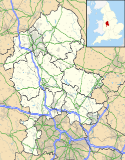
Ubicación de Lower Penn en Staffordshire.
52°33′36.6″N 2°11′18.6″O / 52.560167, -2.1885Coordenadas: 52°33′36.6″N 2°11′18.6″O / 52.560167, -2.1885
Entidad Parroquia civil y pueblo
 • País Bandera del Reino Unido Reino Unido
 • Nación constitutiva Inglaterra
 • Región Midlands del Oeste
 • Condado Staffordshire
 • Distrito South Staffordshire
Superficie  
 • Total 7,43 km²
Población (2001)  
 • Total 974 hab.
 • Densidad 131,09 hab/km²
Huso horario GMT (UTC0)
 • en verano BST (UTC +1)
Código postal WV4
Prefijo telefónico 01902

Lower Penn es una parroquia civil y un pueblo del distrito de South Staffordshire, en el condado de Staffordshire (Inglaterra).

Contenido

Geografía

Según la Oficina Nacional de Estadística británica, Lower Penn tiene una superficie de 7,43 km².[1]

Demografía

Según el censo de 2001, Lower Penn tenía 974 habitantes (48,67% varones, 51,33% mujeres) y una densidad de población de 131,09 hab/km². El 16,22% eran menores de 16 años, el 74,33% tenían entre 16 y 74, y el 9,45% eran mayores de 74. La media de edad era de 43,28 años. Del total de habitantes con 16 o más años, el 23,65% estaban solteros, el 63,48% casados, y el 12,87% divorciados o viudos.[2]

Según su grupo étnico, el 93,44% de los habitantes eran blancos, el 0,31% mestizos, y el 5,95% asiáticos. La mayor parte (95,89%) eran originarios del Reino Unido. El resto de países europeos englobaban al 0,92% de la población, mientras que el 3,18% había nacido en cualquier otro lugar. El cristianismo era profesado por el 79,2%, el hinduismo por el 2,16%, y el sijismo por el 3,4%. El 10,09% no eran religiosos y el 5,15% no marcaron ninguna opción en el censo.[1]

Había 375 hogares con residentes, 9 vacíos, y 3 eran alojamientos vacacionales o segundas residencias.[2]

Referencias

  1. a b Tablas: «Usual Resident Population (KS01) for Amalgamated Parishes», «Ethnic Group (KS06) for Amalgamated Parishes», «Country of Birth (KS05) for Amalgamated Parishes» y «Religion (KS07) for Amalgamated Parishes», disponibles para descarga aquí. Office for National Statistics (inglés).
  2. a b «Area: Lower Penn CP (Parish)» (en inglés). Office for National Statistics. Consultado el 6 de septiembre de 2011.

Enlaces externos


Wikimedia foundation. 2010.

Игры ⚽ Нужно сделать НИР?

Mira otros diccionarios:

  • Lower Penn — Infobox UK place country = England official name= Lower Penn latitude= 52.5551 longitude= 2.1781 shire district= South Staffordshire region= West Midlands shire county = Staffordshire constituency westminster= post town= Wolverhampton postcode… …   Wikipedia

  • Penn, West Midlands — Penn is an area now divided between Wolverhampton in the West Midlands and South Staffordshire. Originally, it was a village in the historic county of Staffordshire. There is considerable confusion about exactly which areas fall within Penn. In… …   Wikipedia

  • Penn Township, Snyder County, Pennsylvania — Infobox Settlement official name = Penn Township, Snyder County, Pennsylvania settlement type = Township nickname = motto = imagesize = image caption = Selinsgrove Speedway is in Penn Township image mapsize = 250x200px map caption = Map of Snyder …   Wikipedia

  • Penn Valley, Pennsylvania — Penn Valley is a town in Lower Merion Township, Pennsylvania. Penn Valley residents share a zip code with either Narberth or Wynnewood because the town does not have its own post office. However, Penn Valley is its own distinct community.Notable… …   Wikipedia

  • Penn Valley — can refer to: Locations *Penn Valley, California, a census designated place in Nevada County, California *Penn Valley, Pennsylvania, a suburb in Lower Merion, Pennsylvania …   Wikipedia

  • Penn (Tamil drama) — Penn is a Tamil drama serial which airs on India s Sun TV network. It first aired in 2006 and is directed by well known director CJ Baskar, who also directed the hit megaserials, Chitti and Annamalai .torylineRanganayaki (portrayed by veteran… …   Wikipedia

  • Lower Saucon Township, Pennsylvania — Geobox Township name = Lower Saucon Township native name = other name = other name1 = category = image size = image caption = flag size = symbol = symbol size = country = United States state = Pennsylvania region = Northampton region type =… …   Wikipedia

  • Penn, William — born Oct. 14, 1644, London, Eng. died July 30, 1718, Buckinghamshire English Quaker leader and founder of Pennsylvania. Expelled from Oxford for his Puritan beliefs, he was sent to manage the family estates in Ireland, where he joined the Society …   Universalium

  • Lower Merion School District — Map of Montgomery County, Pennsylvania Public School Districts. Lower Merion School District is in pink in the southern corner of the county …   Wikipedia

  • Lower Merion Township, Pennsylvania — Geobox Township name = Lower Merion Township native name = other name = other name1 = category = Township image size = image caption = flag size = symbol = symbol size = nickname = motto = country = United States state = Pennsylvania region =… …   Wikipedia

Compartir el artículo y extractos

Link directo
Do a right-click on the link above
and select “Copy Link”