Lyman (Maine)

Lyman (Maine)
Lyman
Pueblo de los Estados Unidos
Lyman
Lyman
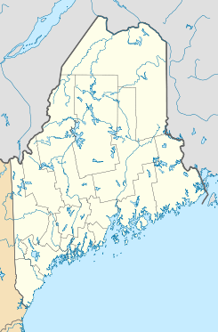
Ubicación en el condado de York en Maine
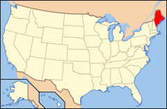
Ubicación de Maine en EE. UU.
43°30′2″N 70°38′58″O / 43.50056, -70.64944Coordenadas: 43°30′2″N 70°38′58″O / 43.50056, -70.64944
Entidad Pueblo
 • País Bandera de los Estados Unidos Estados Unidos
 • Estado Bandera de Maine Maine
 • Condado York
Fundación 1780
Superficie  
 • Total 104,87 km²
 • Tierra 100,99 km²
 • Agua (3,7%) 3,88 km²
Altitud  
 • Media 83 msnm
Población (2010)  
 • Total 4,344 hab.
 • Densidad 41,42 hab/km²
Huso horario Este: UTC-5
 • en verano UTC-4
Código ZIP 04002
Código de área 207
GNIS 582572[1]
Sitio web oficial

Lyman es un pueblo ubicado en el condado de York en el estado estadounidense de Maine. En el Censo de 2010 tenía una población de 4.344 habitantes y una densidad poblacional de 41,42 personas por km².[2]

Contenido

Geografía

Lyman se encuentra ubicado en las coordenadas 43°30′2″N 70°38′58″O / 43.50056, -70.64944. Según la Oficina del Censo de los Estados Unidos, Lyman tiene una superficie total de 104.87 km², de la cual 100.99 km² corresponden a tierra firme y (3.7%) 3.88 km² es agua.[3]

Demografía

Según el censo de 2010,[4] había 4.344 personas residiendo en Lyman. La densidad de población era de 41,42 hab./km². De los 4.344 habitantes, Lyman estaba compuesto por el 97.81% blancos, el 0.21% eran afroamericanos, el 0.16% eran amerindios, el 0.41% eran asiáticos, el 0% eran isleños del Pacífico, el 0.05% eran de otras razas y el 1.36% pertenecían a dos o más razas. Del total de la población el 0.71% eran hispanos o latinos de cualquier raza.[5]

Referencias

  1. «Sistema de Información de Nombres Geográficos: Lyman (Maine)». Geographic Names Information System (en inglés) Consultado el 16 de noviembre de 2011.
  2. «U.S. Gazetteer: Censo de 2010» (en inglés). Oficina del Censo de los Estados Unidos (16 de febrero de 2011). Consultado el 11 de julio de 2011.
  3. «Encuentra un condado» (en inglés). Asociación Nacional de Condados (11 de julio de 2011). Consultado el 11 de julio de 2011.
  4. «American FactFinder» (en inglés). Oficina del Censo de los Estados Unidos. Consultado el 11 de julio de 2011.
  5. «US Board on Geographic Names» (en inglés). Servicio Geológico de los Estados Unidos (25 de octubre de 2007). Consultado el 11 de julio de 2011.

Enlaces externos


Wikimedia foundation. 2010.

Игры ⚽ Поможем написать реферат

Mira otros diccionarios:

  • Lyman, Maine — Infobox Settlement official name = Lyman, Maine settlement type = Town nickname = motto = imagesize = image caption = image |pushpin pushpin label position =left pushpin map caption =Location within the state of Maine pushpin mapsize = |mapsize …   Wikipedia

  • Lyman — may refer to:Surname:* Abe Lyman (4 August 1897 23 October 1957), popular bandleader from the 1920s to the 1940s * Amasa M. Lyman (30 March 1813 – 4 February 1877), early leader in the Latter Day Saint movement * Arthur Lyman (2 February 1932 24… …   Wikipedia

  • Maine locations by per capita income — Maine has the thirty fourth highest per capita income in the United States of America. In 2000, the state s average personal per capita income was $19,533.[citation needed] By 2003, that figure had risen to $28,831.[citation needed] Maine… …   Wikipedia

  • Lyman Abbott — (December 18 1835 October 22 1922) was an American Congregationalist theologian, editor, and author.Abbott was born at Roxbury, Massachusetts, the son of the prolific author, educator and historian Jacob Abbott. Lyman Abbott grew up in Farmington …   Wikipedia

  • Maine School Administrative District 57 — (also abbreviated MSAD 57) is a school district in Maine. The district office is in Waterboro. Its current superintendent is Lynda Green.MSAD 57 is in charge of the seven schools in the district, its buses, and the athletic fieldsOther MSAD 57… …   Wikipedia

  • Lyman Paine — George Lyman Paine, Jr. (November 16, 1901 ndash; July 1, 1978), known as Lyman Paine, was an architect and radical left activist. He is known for his work with the Correspondence Publishing Committee with his wife Freddy Paine, and was closely… …   Wikipedia

  • Maine State Route 5 — ME 5 redirects here. For the former congressional district, see Maine s 5th congressional district. State Route 5 Route information Maintained by MaineDOT …   Wikipedia

  • Maine Student Web Design Awards — The Maine Student Web Design Awards (MSWDA) is a website design contest open to any Maine student currently enrolled in a Maine Middle or High School, or who is a homeschooled student in grades 6 12. Students are encouraged to creatively express… …   Wikipedia

  • Maine State Route 4 — ME 4 redirects here. For the former congressional district, see Maine s 4th congressional district. State Route 4 Route information Maintained by MaineDOT …   Wikipedia

  • Historical U.S. Census Totals for York County, Maine — This article shows U.S. Census totals for York County, Maine, broken down by municipality, from 1900 to 2000.Like most areas of New England, York County is (and has been at all times since well before the 20th century) entirely divided into… …   Wikipedia

Compartir el artículo y extractos

Link directo
Do a right-click on the link above
and select “Copy Link”