St. Just (Puerto Rico)

St. Just (Puerto Rico)
St. Just
Barrio de los Estados Unidos
St. Just
St. Just
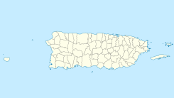
Ubicación en el municipio de Trujillo Alto en Puerto Rico
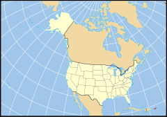
Ubicación de Puerto Rico en EE. UU.
18°22′13″N 66°0′10″O / 18.37028, -66.00278Coordenadas: 18°22′13″N 66°0′10″O / 18.37028, -66.00278
Entidad Barrio
 • País Bandera de los Estados Unidos Estados Unidos
 • Estado libre asociado Bandera de Puerto Rico Puerto Rico
 • Municipio Trujillo Alto
Superficie  
 • Total 5,82 km²
 • Tierra 5,75 km²
 • Agua (1,25%) 0,07 km²
Altitud  
 • Media 39 msnm
Población (2010)  
 • Total 14.635 hab.
 • Densidad 2.514,73 hab/km²
Huso horario Atlántico: UTC-4
 • en verano UTC-4
GNIS 2416037[1]

St. Just es un barrio ubicado en el municipio de Trujillo Alto en el estado libre asociado estadounidense de Puerto Rico. En el Censo de 2010 tenía una población de 14635 habitantes y una densidad poblacional de 2.514,73 personas por km².[2]

Contenido

Geografía

St. Just se encuentra ubicado en las coordenadas 18°22′13″N 66°0′10″O / 18.37028, -66.00278. Según la Oficina del Censo de los Estados Unidos, St. Just tiene una superficie total de 5.82 km², de la cual 5.75 km² corresponden a tierra firme y (1.25%) 0.07 km² es agua.[3]

Demografía

Según el censo de 2010,[4] había 14635 personas residiendo en St. Just. La densidad de población era de 2.514,73 hab./km². De los 14635 habitantes, St. Just estaba compuesto por el 69.19% blancos, el 15.98% eran afroamericanos, el 0.86% eran amerindios, el 0.42% eran asiáticos, el 0.01% eran isleños del Pacífico, el 9.93% eran de otras razas y el 3.61% pertenecían a dos o más razas. Del total de la población el 98.91% eran hispanos o latinos de cualquier raza.[5]

Referencias

  1. «Sistema de Información de Nombres Geográficos: St. Just (Puerto Rico)». Geographic Names Information System (en inglés) Consultado el 20 de noviembre de 2011.
  2. «U.S. Gazetteer: Censo de 2010» (en inglés). Oficina del Censo de los Estados Unidos (16 de febrero de 2011). Consultado el 11 de julio de 2011.
  3. «Encuentra un condado» (en inglés). Asociación Nacional de Condados (11 de julio de 2011). Consultado el 11 de julio de 2011.
  4. «American FactFinder» (en inglés). Oficina del Censo de los Estados Unidos. Consultado el 11 de julio de 2011.
  5. «US Board on Geographic Names» (en inglés). Servicio Geológico de los Estados Unidos (25 de octubre de 2007). Consultado el 11 de julio de 2011.

Enlaces externos


Wikimedia foundation. 2010.

Игры ⚽ Нужен реферат?

Mira otros diccionarios:

  • Puerto Rico Highway 185 — is a main highway that connects Canóvanas, Puerto Rico to Juncos, Puerto Rico and is about 25 kilometers long. It begins in downtown of Canóvanas, very close to Puerto Rico Highway 3 and ends in Puerto Rico Highway 952 and Puerto Rico Highway 30… …   Wikipedia

  • Puerto Rico Highway 149 — (PR 149) is a main highway in Puerto Rico that connects the towns of Manatí in the north coast of Puerto Rico, from PR 22 to Juana Díaz in the south coast, ending at PR 1. It goes through Ciales, and is a divided highway and a wide rural highway… …   Wikipedia

  • Puerto Rico Highway 3 — is the second longest highway in the Commonwealth of Puerto Rico, with near 165 kilometers of length. It runs the coastline of Puerto Rico east of San Juan, beginning in Rio Piedras near Santurce (where it is known as the Avenida 65 de… …   Wikipedia

  • Puerto Rico Highway 183 — is a main highway which begins in the downtown/business area of Caguas, Puerto Rico, near Puerto Rico Highway 1 and ends in Puerto Rico Highway 198 in Las Piedras, Puerto Rico. Measuring near 25 kilometers, it is real rural parallel road of… …   Wikipedia

  • Puerto Rico Highway 908 — is a main highway in the city of Humacao, Puerto Rico. It begins in PR 3 as a two lane per direction road, which ends being that way approaching University of Puerto Rico at Humacao. It intersects PR 30 just before approaching the institution.… …   Wikipedia

  • Puerto Rico — This article is about the Commonwealth of Puerto Rico. For other uses, see Puerto Rico (disambiguation). Commonwealth of Puerto Rico Estado Libre Asociado de Puerto Rico …   Wikipedia

  • Puerto Rico Highway 2 — Infobox road marker state= highway name= name notes= type= route=PRI 2 alternate name=PR 2, PRI 2 maint=Puerto Rico Dept. of Transportation and Public Works (DTOP) section= length mi= length round= length ref= length notes= established=… …   Wikipedia

  • Puerto Rico Islanders — Football club infobox clubname = Puerto Rico Islanders fullname = Puerto Rico Islanders Football Club nickname = Tropa Naranja (Orange Troop) Los Isleños Ola Naranja (Orange Wave) founded = 2003 ground = Juan Ramón Loubriel Stadium Bayamon,… …   Wikipedia

  • Puerto Rico Highway 102 — Infobox road marker state= Puerto Rico highway name= Puerto Rico Highway 102 name notes= type= route= alternate name= maint= section= map notes= map custom= length mi=25.5 length round= length ref= length notes= established= decommissioned=… …   Wikipedia

  • Puerto Rico at the 2004 Summer Olympics — Infobox Olympics Puerto Rico games=2004 Summer competitors=43 (32 men, 11 women) sports=15 flagbearer=Carlos Arroyo officials=Puerto Rico, represented by the Puerto Rico Olympic Committee, competed at the 2004 Summer Olympics in Athens,… …   Wikipedia

Compartir el artículo y extractos

Link directo
Do a right-click on the link above
and select “Copy Link”