Willisburg (Kentucky)

Willisburg (Kentucky)
Willisburg
Ciudad de los Estados Unidos
Willisburg
Willisburg
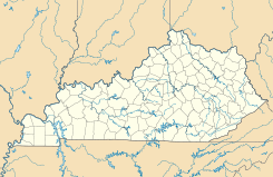
Ubicación en el condado de Washington en Kentucky
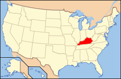
Ubicación de Kentucky en EE. UU.
37°48′32″N 85°7′14″O / 37.80889, -85.12056Coordenadas: 37°48′32″N 85°7′14″O / 37.80889, -85.12056
Entidad Ciudad
 • País Bandera de los Estados Unidos Estados Unidos
 • Estado Bandera de Kentucky Kentucky
 • Condado Washington
Superficie  
 • Total 1,8 km²
 • Tierra 1,78 km²
 • Agua (1,29%) 0,02 km²
Altitud  
 • Media 263 msnm
Población (2010)  
 • Total 282 hab.
 • Densidad 156,66 hab/km²
Huso horario Este: UTC-5
 • en verano UTC-4
GNIS 2405750[1]

Willisburg es una ciudad ubicada en el condado de Washington en el estado estadounidense de Kentucky. En el Censo de 2010 tenía una población de 282 habitantes y una densidad poblacional de 156,66 personas por km².[2]

Contenido

Geografía

Willisburg se encuentra ubicada en las coordenadas 37°48′32″N 85°7′14″O / 37.80889, -85.12056. Según la Oficina del Censo de los Estados Unidos, Willisburg tiene una superficie total de 1.8 km², de la cual 1.78 km² corresponden a tierra firme y (1.29%) 0.02 km² es agua.[3]

Demografía

Según el censo de 2010,[4] había 282 personas residiendo en Willisburg. La densidad de población era de 156,66 hab./km². De los 282 habitantes, Willisburg estaba compuesto por el 97.87% blancos, el 1.06% eran afroamericanos, el 0% eran amerindios, el 0% eran asiáticos, el 0% eran isleños del Pacífico, el 0.35% eran de otras razas y el 0.71% pertenecían a dos o más razas. Del total de la población el 2.48% eran hispanos o latinos de cualquier raza.[5]

Referencias

  1. «Sistema de Información de Nombres Geográficos: Willisburg (Kentucky)». Geographic Names Information System (en inglés) Consultado el 21 de noviembre de 2011.
  2. «U.S. Gazetteer: Censo de 2010» (en inglés). Oficina del Censo de los Estados Unidos (16 de febrero de 2011). Consultado el 11 de julio de 2011.
  3. «Encuentra un condado» (en inglés). Asociación Nacional de Condados (11 de julio de 2011). Consultado el 11 de julio de 2011.
  4. «American FactFinder» (en inglés). Oficina del Censo de los Estados Unidos. Consultado el 11 de julio de 2011.
  5. «US Board on Geographic Names» (en inglés). Servicio Geológico de los Estados Unidos (25 de octubre de 2007). Consultado el 11 de julio de 2011.

Enlaces externos


Wikimedia foundation. 2010.

Игры ⚽ Поможем решить контрольную работу

Mira otros diccionarios:

  • Willisburg, Kentucky — Infobox Settlement official name = Willisburg, Kentucky settlement type = City nickname = motto = imagesize = 250px image caption = Downtown Willisburg image mapsize = 250px map caption = Location of Willisburg, Kentucky mapsize1 = map caption1 …   Wikipedia

  • Kentucky locations by per capita income — Kentucky is the fortieth richest state in the United States of America, with a per capita income of $18,093 (2000). Kentucky Places by Per Capita Income # Mockingbird Valley, Kentucky ndash; $134,745 # Glenview, Kentucky ndash; $85,094 # Rolling… …   Wikipedia

  • Willisburg — Willisburg, KY U.S. city in Kentucky Population (2000): 304 Housing Units (2000): 119 Land area (2000): 0.532964 sq. miles (1.380370 sq. km) Water area (2000): 0.000000 sq. miles (0.000000 sq. km) Total area (2000): 0.532964 sq. miles (1.380370… …   StarDict's U.S. Gazetteer Places

  • Willisburg, KY — U.S. city in Kentucky Population (2000): 304 Housing Units (2000): 119 Land area (2000): 0.532964 sq. miles (1.380370 sq. km) Water area (2000): 0.000000 sq. miles (0.000000 sq. km) Total area (2000): 0.532964 sq. miles (1.380370 sq. km) FIPS… …   StarDict's U.S. Gazetteer Places

  • Willisburg Lake — Infobox lake lake name = Willisburg Lake image lake = caption lake = image bathymetry = caption bathymetry = location = Washington County, Kentucky coords = type = reservoir inflow = outflow = catchment = basin countries = United States length =… …   Wikipedia

  • Kentucky — This article is about the Commonwealth of Kentucky. For other uses, see Kentucky (disambiguation). Commonwealth of Kentucky …   Wikipedia

  • Demographics of Kentucky — Kentucky population density map. Historical populations Census …   Wikipedia

  • National Register of Historic Places listings in Washington County, Kentucky — Location of Washington County in Kentucky This is a list of the National Register of Historic Places listings in Washington County, Kentucky. It is intended to be a complete list of the properties and districts on the National Register of… …   Wikipedia

  • List of cities in Kentucky — There are 419 cities in the U.S. State of Kentucky that are recognized by the state. City Classes Kentucky cities are divided into six classes based on their population. Over 400 classification related laws affect public safety, alcohol beverage… …   Wikipedia

  • Washington County, Kentucky — Infobox U.S. County county = Washington County state = Kentucky founded year = 1792 founded date = seat wl = Springfield largest city wl = area total sq mi = 302 area total km2 = 781 area land sq mi = 301 area land km2 = 779 area water sq mi = 1… …   Wikipedia

Compartir el artículo y extractos

Link directo
Do a right-click on the link above
and select “Copy Link”