- Distrito de Nordfriesland
-
Armas Mapa 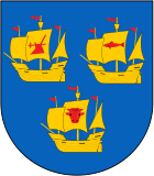
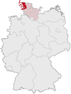
Datos Básicos Bundesland: Schleswig-Holstein Capital de Distrito: Husum Superficie: 2.046,98 km² Habitantes: 166.654 (31 de marzo 2005) Densidad de población: 81 hab./km² Código de Distrito: 01 0 54 Matrícula: NF Composición: 135 Gemeinden Dirección de la Administración: Marktstraße 6
25813 HusumWebsite: www.nordfriesland.de Ubicación del Distrito 
El Distrito de Nordfriesland (en alemán Kreis Nordfriesland y en (danés: Nordfrisland, frisio: Nordfraschlönj/Nordfriislon) es de los distritos (Landkreis) más septentrionales de Alemania. Es junto con los distritos de Rendsburg-Eckernförde y Schleswig-Flensburg el tercero en superficie del estado federal de Schleswig-Holstein. Posee minorías esta región (denominada a veces como Nordfriesland Heimat) de nordfrisios y daneses en el que se hablan cinco dialectos, a parte del alemán: Plattdeutsch, Danés, Südjütisch y Friesisch en lo que se denomina dialectos nordfrisios) de esta forma el distrito de Nordfriesland es uno de los más ricos en dialectos de Alemania. La capital del distrito es la ciudad de Husum.
Contenido
Geografia
El Distrito de Nordfriesland se ubica al noroeste del estado federal y limita al norte con Dinamarca, al este tiene frontera administrativa con el distrito de Schleswig-Flensburg (el Fluss forma parte de una de las fronteras naturales y al sur limita con el distrito de Dithmarschen (el eider hace de frontera natural). Al oeste tiene costa con el Mar del Norte. Uno de los acantilados más septentrionales es la isla Sylt, la denominada Ellenbogen, es de los territorios más al norte de Alemania. Los puntos de mayor altitud son el Sandesberg en el municipio de Ostenfeld (Husum) con una altitud de 54 m sobre NN y el Uwe-Düne en Kampen con 52,5 metros sobre el Normalnull.
Composición del Distrito
(Habitantes a 30 de Junio de 2005)
Municipios/Ciudades - 1. Bredstedt, Ciudad (5.095)
- 2. Husum, Ciudad (22.549)
- 3. Leck * (7.659)
- 4. Niebüll, Ciudad (8.841)
- 5. Reußenköge, (358)
- 6. Sankt Peter-Ording (4.093)
- 7. Tönning, Ciudad (5.017)
- 8. Westerland, Ciudad (9.072)
Unión de Municipios (Amt)* Sitz der Amtsverwaltung
- 1. Amt Bökingharde
- Dagebüll (939)
- Galmsbüll (664)
- Risum-Lindholm * (3.627)
- Stedesand (870)
- 2. Amt Bredstedt-Land
- Ahrenshöft (511)
- Almdorf (533)
- Bohmstedt (755)
- Breklum * (2.325)
- Drelsdorf (1.281)
- Goldebek (353)
- Goldelund (394)
- Högel (470)
- Joldelund (732)
- Kolkerheide (68)
- Lütjenholm (337)
- Sönnebüll (234)
- Struckum (990)
- Vollstedt (165)
- 3. Amt Eiderstedt
- Garding, Stadt * (2.688)
- Garding, Kirchspiel (311)
- Grothusenkoog (22)
- Katharinenheerd (185)
- Kotzenbüll (247)
- Norderfriedrichskoog (34)
- Oldenswort (1.326)
- Osterhever (252)
- Poppenbüll (205)
- Tating (975)
- Tetenbüll (639)
- Tümlauer Koog (112)
- Vollerwiek (221)
- Welt (223)
- Westerhever (125)
- 4. Amt Föhr-Amrum
- Alkersum (416)
- Borgsum (343)
- Dunsum (79)
- Midlum (362)
- Nebel (968)
- Nieblum (636)
- Norddorf (644)
- Oevenum (494)
- Oldsum (564)
- Süderende (185)
- Utersum (412)
- Witsum (46)
- Wittdün (676)
- Wrixum (689)
- Wyk auf Föhr, Stadt (4.423) *
- 5. Amt Friedrichstadt
- Drage (581)
- Friedrichstadt, Stadt * (2.479)
- Koldenbüttel (930)
- Seeth (708)
- Uelvesbüll (270)
- Witzwort (979)
- 6. Amt Hattstedt
- Arlewatt (335)
- Hattstedt * (2.454)
- Hattstedtermarsch (317)
- Horstedt (749)
- Olderup (460)
- Wobbenbüll (464)
- 7. Amt Karrharde
(Sitz: Leck)
- Achtrup (1.548)
- Bramstedtlund (237)
- Enge-Sande (1.150)
- Karlum (218)
- Klixbüll (932)
- Ladelund (1.516)
- Sprakebüll (221)
- Stadum (1.070)
- Tinningstedt (209)
- Westre (400)
- 8. Amt Landschaft Sylt
- Hörnum (Sylt) (930)
- Kampen (Sylt) (635)
- List (2.632)
- Rantum (Sylt) (537)
- Sylt-Ost * (5.789)
- Wenningstedt-Braderup (Sylt) (1.595)
- 9. Amt Nordstrand
- Elisabeth-Sophien-Koog (47)
- Nordstrand * (2.270)
- 10. Amt Pellworm
- Gröde (14)
- Hooge (86)
- Langeneß (133)
- Pellworm * (1.139)
- 11. Amt Stollberg
- Bargum (608)
- Bordelum (1.991)
- Langenhorn * (3.092)
- Ockholm (372)
- 12. Amt Süderlügum
- Bosbüll (206)
- Braderup (671)
- Ellhöft (131)
- Holm (80)
- Humptrup (764)
- Lexgaard (64)
- Süderlügum * (2.239)
- Uphusum (411)
- 13. Amt Treene
- Fresendelf (92)
- Hude (197)
- Mildstedt * (3.695)
- Oldersbek (641)
- Ostenfeld (Husum) (1.546)
- Ramstedt (448)
- Rantrum (1.591)
- Schwabstedt (1.348)
- Simonsberg (866)
- Süderhöft (20)
- Südermarsch (141)
- Winnert (760)
- Wisch (134)
- Wittbek (785)
- 14. Amt Viöl
- Ahrenviöl (510)
- Ahrenviölfeld (269)
- Behrendorf (615)
- Bondelum (216)
- Haselund (893)
- Immenstedt (655)
- Löwenstedt (673)
- Norstedt (422)
- Oster-Ohrstedt (674)
- Schwesing (940)
- Sollwitt (318)
- Viöl * (1.900)
- Wester-Ohrstedt (1.090)
- 15. Amt Wiedingharde
(Sitz: Niebüll)
- Aventoft (508)
- Emmelsbüll-Horsbüll (1.056)
- Friedrich-Wilhelm-Lübke-Koog (165)
- Klanxbüll (941)
- Neukirchen (1.315)
- Rodenäs (452)
Mapa General del Distrito

Véase también
Literatura
- Nordfriisk Instituut (Hrsg.) Geschichte Nordfrieslands, Heide Boyens & Co 1995. ISBN 3-8042-0759-6
Enlaces externos
 Wikimedia Commons alberga contenido multimedia sobre Distrito de NordfrieslandCommons.
- Offizielle Website des Kreises Nordfriesland
- Wirtschaftsförderungsgesellschaft Nordfriesland
- Nordfriisk Instituut
Coordenadas:
Categoría:- Distritos de Schleswig-Holstein
Wikimedia foundation. 2010.

