Huntingburg (Indiana)

Huntingburg (Indiana)
Huntingburg
Ciudad de los Estados Unidos
Huntingburg
Huntingburg
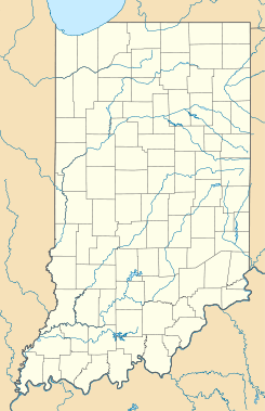
Ubicación en el condado de Dubois en Indiana
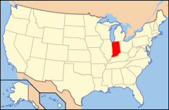
Ubicación de Indiana en EE. UU.
38°18′3″N 86°57′43″O / 38.30083, -86.96194Coordenadas: 38°18′3″N 86°57′43″O / 38.30083, -86.96194
Entidad Ciudad
 • País Bandera de los Estados Unidos Estados Unidos
 • Estado Bandera de Indiana Indiana
 • Condado Dubois
Alcalde Marvin Belcher
Superficie  
 • Total 13,66 km²
 • Tierra 13,11 km²
 • Agua (4,04%) 0,55 km²
Altitud  
 • Media 148 msnm
Población (2010)  
 • Total 6.057 hab.
 • Densidad 443,42 hab/km²
Huso horario Este: UTC-5
 • en verano UTC-4
Código ZIP 47542
Código de área 812
GNIS 2394451[1]
Sitio web oficial

Huntingburg es una ciudad ubicada en el condado de Dubois en el estado estadounidense de Indiana. En el Censo de 2010 tenía una población de 6057 habitantes y una densidad poblacional de 443,42 personas por km².[2]

Contenido

Geografía

Huntingburg se encuentra ubicada en las coordenadas 38°18′3″N 86°57′43″O / 38.30083, -86.96194. Según la Oficina del Censo de los Estados Unidos, Huntingburg tiene una superficie total de 13.66 km², de la cual 13.11 km² corresponden a tierra firme y (4.04%) 0.55 km² es agua.[3]

Demografía

Según el censo de 2010,[4] había 6057 personas residiendo en Huntingburg. La densidad de población era de 443,42 hab./km². De los 6057 habitantes, Huntingburg estaba compuesto por el 87.27% blancos, el 0.54% eran afroamericanos, el 0.17% eran amerindios, el 0.31% eran asiáticos, el 0% eran isleños del Pacífico, el 9.86% eran de otras razas y el 1.85% pertenecían a dos o más razas. Del total de la población el 18.54% eran hispanos o latinos de cualquier raza.[5]

Referencias

  1. «Sistema de Información de Nombres Geográficos: Huntingburg (Indiana)». Geographic Names Information System (en inglés) Consultado el 21 de noviembre de 2011.
  2. «U.S. Gazetteer: Censo de 2010» (en inglés). Oficina del Censo de los Estados Unidos (16 de febrero de 2011). Consultado el 11 de julio de 2011.
  3. «Encuentra un condado» (en inglés). Asociación Nacional de Condados (11 de julio de 2011). Consultado el 11 de julio de 2011.
  4. «American FactFinder» (en inglés). Oficina del Censo de los Estados Unidos. Consultado el 11 de julio de 2011.
  5. «US Board on Geographic Names» (en inglés). Servicio Geológico de los Estados Unidos (25 de octubre de 2007). Consultado el 11 de julio de 2011.

Enlaces externos


Wikimedia foundation. 2010.

Игры ⚽ Нужен реферат?

Mira otros diccionarios:

  • Huntingburg, Indiana — Infobox Settlement official name = City of Huntingburg, Indiana settlement type = City nickname = imagesize = image caption = image imagesize = image caption = image mapsize = 250x200px map caption = Location in the state of Indiana mapsize1 =… …   Wikipedia

  • Huntingburg League Stadium — is a stadium in Huntingburg, Indiana. It is primarily used for baseball and was the home of Dubois County Dragons before they moved to Kenosha, Wisconsin in 2003. It currently houses the Dubois County Bombers. The ballpark has a capacity of 2,783 …   Wikipedia

  • Indiana locations by per capita income — Indiana has the twenty seventh highest per capita income in the United States of America, at $20,397 (2000). Its personal per capita income is $28,783 (2003).Indiana Counties Ranked by Per Capita IncomeThere are ninety two counties located in… …   Wikipedia

  • Southridge High School (Huntingburg, Indiana) — Southridge High School is a 9 12 grade public secondary school, one of four schools in the Southwest Dubois County School Corporation in Dubois County, Indiana. It is located on the south side of Huntingburg on US 231. Southridge is a member of… …   Wikipedia

  • Huntingburg — Huntingburg, IN U.S. city in Indiana Population (2000): 5598 Housing Units (2000): 2267 Land area (2000): 3.627191 sq. miles (9.394380 sq. km) Water area (2000): 0.000000 sq. miles (0.000000 sq. km) Total area (2000): 3.627191 sq. miles (9.394380 …   StarDict's U.S. Gazetteer Places

  • Huntingburg, IN — U.S. city in Indiana Population (2000): 5598 Housing Units (2000): 2267 Land area (2000): 3.627191 sq. miles (9.394380 sq. km) Water area (2000): 0.000000 sq. miles (0.000000 sq. km) Total area (2000): 3.627191 sq. miles (9.394380 sq. km) FIPS… …   StarDict's U.S. Gazetteer Places

  • Huntingburg — (spr. hönnt ), Stadt im nordamerikan. Staat Indiana, Grafschaft Dubois, hat (1900) 2527 Einwohner …   Meyers Großes Konversations-Lexikon

  • Indiana State Road 64 — Infobox road state=IN type=IN route=64 alternate name= length mi=107.5 length round=1 length ref= [http://illi indi.com/EndsPage.php?id=1064 section=1 Indiana Highway Ends SR 64] ] established= direction a=West starting terminus= junction=… …   Wikipedia

  • Indiana — This article is about the U.S. state of Indiana. For other uses, see Indiana (disambiguation). Hoosier State redirects here. For the passenger train, see Hoosier State (train). State of Indiana …   Wikipedia

  • Huntingburg — Original name in latin Huntingburg Name in other language HNB State code US Continent/City America/Indiana/Vincennes longitude 38.29894 latitude 86.955 altitude 150 Population 6057 Date 2011 05 14 …   Cities with a population over 1000 database

Compartir el artículo y extractos

Link directo
Do a right-click on the link above
and select “Copy Link”