- Ibicaraí
-
Ibicaraí http://www.google.con.br/imgres?q=bandera+de+ibicarai&hl=pt-BR&safe=off&biw=1280&bih=620&gbv=2&tbm=isch&tbnid=1GqkJaoV-gohUM:&imgrefurl=http://www.bahianoticias.com.br/noticias/2010/7/30/noticia.html&docid=CY1krEPg32XwpM&w=350&h=244&ei=bPc9TrO3EKS20AGCj6mCBA&zoom=1&iact=hc&vpx=385&vpy=285&dur=362&hovh=187&hovw=269&tx=136&ty=158&page=1&tbnh=143&tbnw=193&start=0&ndsp=15&ved=1t:429,r:11,s:0 Otros nombres: Palestina 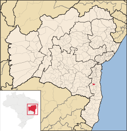
MapaCoordenadas: Coordenadas: Entidad Municipio • País  Brasil
• Estado Bahía • Mesorregión Sur Bahiano • Microrregión Ilhéus-Itabuna • Fundación 22 de octubre de 1952 Superficie • Total 231.938 km²[1] Clima Tropical Húmedo Población • Total 24,272 hab. • Densidad 104,65 hab./km² hab/km² Gentilicio ibicaraiense PIB (nominal) • Total 81.876,061 mil • PIB per cápita 3276.48 IDH (PNUD/2000[2] ) 0.634 Datos mesorregión IBGE/2008[3] Datos microrregión IBGE/2008[3] Municipios vecinos Almadina, Itabuna, Itapé, Coaraci, Floresta Azul. Dist. Cap. 470 de Salvador Ibicaraí es un municipio brasileño del estado de Bahía. De acuerdo con el último censo realizado por el IBGE en 2010, Ibicaraí cuenta 24.272 habitantes.
Fue elevada a la condición de villa en 1937 bajo la denominación de "Villa Palestina". Por la ley estatal nº 141, de 1941, creó el nombre de Ibicaraí, que en la lengua Tupí quiere decir "Tierra Sagrada".
Localización
El municipio de Ibicaraí está localizado a 470 kms de Salvador, en la Zona Centro Oeste de la Región Cacaueira. Ocupa actualmente el área de 231,938km².
Referencias
- ↑ . Resolução da Presidência do IBGE de n° 5 (R.PR-5/02) (10 out. 2002). Consultado el 5 diez. 2010.
- ↑ «Ranking decreciente del IDH-M de los municipios del Brasil». Programa das Nações Unidas para o Desenvolvimento (PNUD) (2000). Consultado el 11 de octubre de 2008.
- ↑ a b «División Territorial del Brasil». Instituto Brasileiro de Geografia e Estatística (IBGE) (1 de julio de 2008). Consultado el 11 de octubre de 2008.
- Este artículo fue creado a partir de la traducción automática del artículo Ibicaraí de la Wikipedia en portugués, concretamente de esta versión, bajo licencia Creative Commons Atribución Compartir Igual 3.0 y GFDL.
Categoría:- Localidades de Bahía

Wikimedia foundation. 2010.