Stow (Maine)

Stow (Maine)
Stow
Pueblo de los Estados Unidos
Stow
Stow
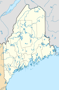
Ubicación en el condado de Oxford en Maine
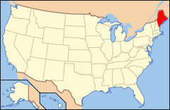
Ubicación de Maine en EE. UU.
44°12′5″N 70°58′20″O / 44.20139, -70.97222Coordenadas: 44°12′5″N 70°58′20″O / 44.20139, -70.97222
Entidad Pueblo
 • País Bandera de los Estados Unidos Estados Unidos
 • Estado Bandera de Maine Maine
 • Condado Oxford
Superficie  
 • Total 63,05 km²
 • Tierra 62,71 km²
 • Agua (0,53%) 0,34 km²
Altitud  
 • Media 187 msnm
Población (2010)  
 • Total 385 hab.
 • Densidad 6,11 hab/km²
Huso horario Este: UTC-5
 • en verano UTC-4
Código ZIP 04037
Código de área 207
GNIS 582752[1]

Stow es un pueblo ubicado en el condado de Oxford en el estado estadounidense de Maine. En el Censo de 2010 tenía una población de 385 habitantes y una densidad poblacional de 6,11 personas por km².[2]

Contenido

Geografía

Stow se encuentra ubicado en las coordenadas 44°12′5″N 70°58′20″O / 44.20139, -70.97222. Según la Oficina del Censo de los Estados Unidos, Stow tiene una superficie total de 63.05 km², de la cual 62.71 km² corresponden a tierra firme y (0.53%) 0.34 km² es agua.[3]

Demografía

Según el censo de 2010,[4] había 385 personas residiendo en Stow. La densidad de población era de 6,11 hab./km². De los 385 habitantes, Stow estaba compuesto por el 97.66% blancos, el 0.78% eran afroamericanos, el 0.26% eran amerindios, el 0% eran asiáticos, el 0% eran isleños del Pacífico, el 0% eran de otras razas y el 1.3% pertenecían a dos o más razas. Del total de la población el 0% eran hispanos o latinos de cualquier raza.[5]

Referencias

  1. «Sistema de Información de Nombres Geográficos: Stow (Maine)». Geographic Names Information System (en inglés) Consultado el 20 de noviembre de 2011.
  2. «U.S. Gazetteer: Censo de 2010» (en inglés). Oficina del Censo de los Estados Unidos (16 de febrero de 2011). Consultado el 11 de julio de 2011.
  3. «Encuentra un condado» (en inglés). Asociación Nacional de Condados (11 de julio de 2011). Consultado el 11 de julio de 2011.
  4. «American FactFinder» (en inglés). Oficina del Censo de los Estados Unidos. Consultado el 11 de julio de 2011.
  5. «US Board on Geographic Names» (en inglés). Servicio Geológico de los Estados Unidos (25 de octubre de 2007). Consultado el 11 de julio de 2011.

Enlaces externos


Wikimedia foundation. 2010.

Игры ⚽ Поможем решить контрольную работу

Mira otros diccionarios:

  • Stow, Maine — Infobox Settlement official name = Stow, Maine settlement type = Town nickname = motto = imagesize = image caption = image |pushpin pushpin label position =left pushpin map caption =Location within the state of Maine pushpin mapsize = |mapsize =… …   Wikipedia

  • Stow — may refer to ;Placenames:;United Kingdom::*Stow cum Quy, Cambridgeshire:*Stow, Lincolnshire (also known as Stow in Lindsey):*Stow, Scottish Borders, properly Stow of Wedale:*Stow Bardolph, Norfolk:*Stow on the Wold, Gloucestershire:*Stowmarket… …   Wikipedia

  • Stow — ist der Name folgender Orte in den USA: Stow (Maine) Stow (Massachusetts) Stow (Ohio) in Großbritannien: Stow (Lincolnshire) Stow (Schottland) Stow cum Quy, Cambridgeshire Stow on the Wold, Gloucestershire Stow ist der Familienname folgender… …   Deutsch Wikipedia

  • Maine locations by per capita income — Maine has the thirty fourth highest per capita income in the United States of America. In 2000, the state s average personal per capita income was $19,533.[citation needed] By 2003, that figure had risen to $28,831.[citation needed] Maine… …   Wikipedia

  • Maine State Route 113 — State Route 113 Route information Maintained by MaineDOT Length: 54.81 mi (88.21 km) …   Wikipedia

  • Stow Wengenroth — (1906 1978) was an American artist and lithographer, born in 1906 in Brooklyn, New York. Wengenroth was once called America s greatest living artist working in black and white by the American realist painter Andrew Wyeth, and he is generally… …   Wikipedia

  • Historical U.S. Census Totals for Oxford County, Maine — This article shows U.S. Census totals for Oxford County, Maine, broken down by municipality, from 1900 to 2000.There are two types of incorporated municipalities in Maine, towns and cities. The tables in the New England Historical U.S. Census… …   Wikipedia

  • Oxford County, Maine — Location in the state of Maine …   Wikipedia

  • National Register of Historic Places listings in Oxford County, Maine — Location of Oxford County in Maine This is a list of the National Register of Historic Places listings in Oxford County, Maine. This is intended to be a complete list of the properties and districts on the National Register of Historic Places in… …   Wikipedia

  • Cold River (Maine — The Cold River is a 16.7 mile long (26.9 km)[1] river in western Maine in the United States. It very briefly enters New Hampshire as well. It is part of the Saco River drainage basin. The Cold River begins at the height of land in Evans… …   Wikipedia

Compartir el artículo y extractos

Link directo
Do a right-click on the link above
and select “Copy Link”