- Alandroal
-
Alandroal 
Bandera
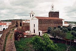
Escudo Castillo e iglesia matriz de Alandroal
País  Portugal
• Región Alentejo • Subregión Alentejo Central • Distrito Évora • Antigua provincia Alto Alentejo Ubicación Superficie 544,86 km² Número de freguesias 6 Fundación 1486 Población 6 585 hab. (2001) • Densidad 12 hab./km² Gentilicio Alandroalense Código postal 7250Fiestas mayores Martes de Pascua Patrón Nossa Senhora da Boa Nova Dirección del
ayuntamientoPraça da República Dirección de
correo electrónicoSitio web www.cm-alandroal.pt Alandroal es una vila portuguesa pertenciente al Distrito de Évora, región de Alentejo y subregión de Alentejo Central, con cerca de 1 900 habitantes. Se ubica a 341 m de altitud sobre el mar.
Contenido
Localización
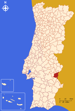
Es sede de un municipio con 544,86 km² de área y 6 585 habitantes (2001), subdividido en 6 freguesias. Los municipio están limitados al norte por el município de Vila Viçosa, al este por España, al sur por Mourão y por Reguengos de Monsaraz y al oeste por Redondo. El concelho de Alandroal fue anexado, en el siglo XIX, los territorios de los antiguos municipios de Terena y Juromenha. El propio Alandroal es una de las tres vilas del concelho, siendo las otras Terena y Juromenha.
Historia
el Alandroal fue elevado a la categoría de vila en 1486, por la foral atribuida por D. João II. La vila incluye apenas la freguesia de Nossa Senhora da Conceição.
Población
Población del concelho de Alandroal (1801 – 2004) 1801 1849 1900 1930 1960 1981 1991 2001 2004 1541 4651 7493 10444 12089 8124 7347 6585 6293 Freguesías
Las freguesias de Alandroal son las siguientes:
- Nossa Senhora da Conceição
- Capelins (Santo António)
- Juromenha (Nossa Senhora do Loreto)
- São Brás dos Matos (Mina do Bugalho)
- Santiago Maior (Alandroal)
- Terena (São Pedro)
Ilustres
- Diogo Lopes de Sequeira (1465-1530), Gobernador de las Indias (1518-1522)
Patrimonio
- Fortaleza de Juromenha
Enlaces externos
 Wikimedia Commons alberga contenido multimedia sobre Alandroal. Commons
Wikimedia foundation. 2010.
