- Organización territorial del Reino Unido
-
La organización territorial del Reino Unido, un Estado regional, se asienta sobre un complejo sistema jerarquizado de administración en varios niveles y especialización según el tipo de competencias ejercidas:
El estado esta compuesta de 4 paises:
Cada pais esta subdividida en y ciertas competencias devueltas a las autoridades locales.
Regiones del Reino Unido País Región Condado Inglaterra Nordeste de Inglaterra 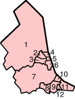
Ceremonial Unitario 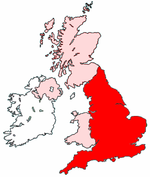
Capital Londres 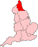
Capital Northumberland (1) Superficie 130.395 km² Superficie km² Tyne and Wear (2, 3, 4, 5 y 6) Habitantes 51.113.205 hab. (est. 2009) Habitantes hab County Durham Darlington (8) Hartlepool (9) Stockton-on-Tees (North) (10) North Yorkshire (solo parte) Stockton-on-Tees (South) (10) Redcar and Cleveland (11) Middlesbrough (12) Noroeste de Inglaterra Cheshire Cheshire 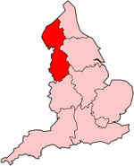
Capital [[]] Warrington Superficie km² Halton Habitantes hab Cumbria Greater Manchester Lancashire Lancashire Blackpool Blackburn with Darwen Merseyside Yorkshire y Humber 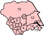
South Yorkshire (1, 2,3 y 4) 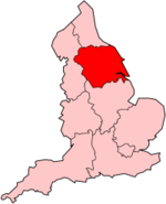
Capital [[]] West Yorkshire (5,6,7,8 y 9) Superficie km² North Yorkshire (solo parte) North Yorkshire (10) Habitantes hab York (11) East Riding of Yorkshire East Riding of Yorkshire (12) Kingston upon Hull (13) Lincolnshire (solo parte) North Lincolnshire (14) North East Lincolnshire (15) East Midlands 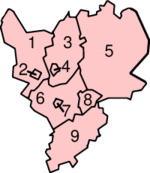
Derbyshire Derbyshire (1) 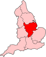
Capital [[]] Derby (2) Superficie km² Nottinghamshire Nottinghamshire (3) Habitantes hab Nottingham (4) Lincolnshire (5) Leicestershire Leicestershire (6) Leicester (7) Rutland (8) Northamptonshire (9) West Midlands Herefordshire 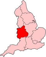
Capital [[]] Shropshire Shropshire Superficie km² Telford and Wrekin Habitantes hab Staffordshire Staffordshire Stoke-on-Trent Warwickshire West Midlands Worcestershire Este de Inglaterra 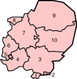
Essex Thurrock (1) 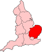
Capital [[]] Southend-on-Sea (2) Superficie km² Essex (3) Habitantes hab Hertfordshire (4) Bedfordshire Luton (5) Bedfordshire (6) Cambridgeshire Cambridgeshire (7) Peterborough (8) Norfolk (9) Suffolk (10) Gran Londres 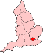
Capital [[]] Superficie km² Habitantes hab South East England Berkshire West Berkshire 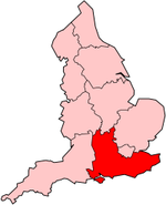
Capital [[]] Reading Superficie km² Wokingham Habitantes hab Bracknell Forest Windsor and Maidenhead Slough Buckinghamshire Buckinghamshire Milton Keynes East Sussex East Sussex Brighton & Hove Hampshire Hampshire Southampton Portsmouth Isle of Wight Kent Kent Medway Oxfordshire Surrey West Sussex South West England 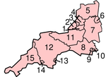
Somerset Bath and North East Somerset (1) 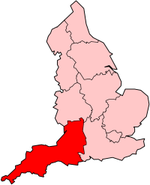
Capital [[]] North Somerset (2) Superficie km² Somerset (11) Habitantes hab Bristol (3) Gloucestershire South Gloucestershire (4) Gloucestershire (5) Wiltshire Swindon (6) Wiltshire (7) Dorset Dorset (8) Poole (9) Bournemouth (10) Devon Devon (12) Torbay (13) Plymouth (14) Cornwall Isles of Scilly Cornwall (15) Escocia («Scotland») Regiones Council Areas of Scotland 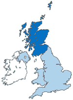
Capital Edinburgo 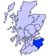
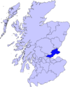
Borders Superficie 78.772 km² Capital [[]] 30. Borders (Became Scottish Borders) Habitantes 5.062.0115 hab (2001) Superficie km² Habitantes hab 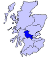
Central Capital [[]] 13. Clackmannan (Became Clackmannanshire) Superficie km² 08. Falkirk Habitantes hab 24. Stirling 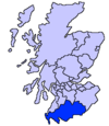
Dumfries and Galloway Capital [[]] 18. Dumfries and Galloway Superficie km² Habitantes hab Fife Capital [[]] 14. Fife Superficie km² Habitantes hab 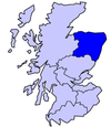
Grampian Capital [[]] 17. Aberdeenshire Superficie km² 18. City of Aberdeen (Became Aberdeen City) Habitantes hab 19. Moray 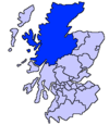
Highland Capital [[]] 20. Highland Superficie km² Habitantes hab 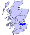
Lothian Capital [[]] 12. East Lothian Superficie km² 10. City of Edinburgh Habitantes hab 11. Midlothian 09. West Lothian 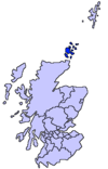
Orkney Capital [[]] Orkney Islands Superficie km² Habitantes hab 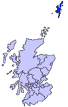
Shetland Capital [[]] Shetland Islands Superficie km² Habitantes hab 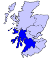
Strathclyde Capital [[]] 22. Argyll and Bute Superficie km² 03. Dumbarton and Clydebank (Became West Dunbartonshire) Habitantes hab 26. East Ayrshire 04. East Dunbartonshire 06. East Renfrewshire 05. City of Glasgow (Became Glasgow City) 01. Inverclyde 25. North Ayrshire 07. North Lanarkshire 02. Renfrewshire 27. South Ayrshire 29. South Lanarkshire 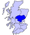
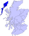
Tayside Capital [[]] 16. Angus Superficie km² 15. City of Dundee (Became Dundee City) Habitantes hab 13. Perth and Kinross Western Isles Capital [[]] 21. Western Isles (Became Na h-Eileanan Siar) Superficie km² Habitantes hab Gales («Wales») Areas Counties 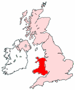
Capital Cardiff 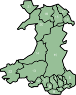
Nombre Area Counties Counties Boroughs Cities Superficie 20,779 km² 01. Merthyr Tydfil (Merthyr Tudful) - Merthyr Tydfil - Habitantes 2.903.085 hab. (2001) 02. Caerphilly (Caerffili) - Caerphilly - 03. Blaenau Gwent - Blaenau Gwent - 04. Torfaen (Tor-faen) - Torfaen - 05.| Monmouthshire (Sir Fynwy) Monmouthshire - 06. Newport (Casnewydd) - - Newport 07. Cardiff (Caerdydd) - - Cardiff 08. Vale of Glamorgan (Bro Morgannwg) - Vale of Glamorgan - 09. Bridgend (Pen-y-bont ar Ogwr) - Bridgend - 10. Rhondda Cynon Taff (Rhondda Cynon Tâf) - Rhondda Cynon Taff - 11. Neath Port Talbot (Castell-nedd Port Talbot) - Neath Port Talbot - 12. Swansea (Abertawe) - - Swansea 13. Carmarthenshire (Sir Gaerfyrddin) Carmarthenshire - - 14. Ceredigion Ceredigion - - 15. Powys Powys - - 16. Wrexham (Wrecsam) - Wrexham - 17. Flintshire (Sir y Fflint) Flintshire - - 18. Denbighshire (Sir Ddinbych) Denbighshire - - 19. Conwy - Conwy - 20. Gwynedd Gwynedd - - 21. Isle of Anglesey (Ynys Môn) Isle of Anglesey - - 22. Pembrokeshire (Sir Benfro) Pembrokeshire - - Irlanda del Norte Distritos 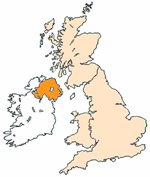
Capital Belfast 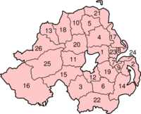
01. Antrim Superficie 13.843 km² 02. Ards Habitantes 1.685.267 hab. (2001) 03. Armagh 04. Ballymena 05. Ballymoney 06. Banbridge 07. Belfast 08. Carrickfergus 09. Castlereagh 10. Coleraine 11. Cookstown 12. Craigavon 13. Derry 14. Down 15. Dungannon and South Tyrone 16. Fermanagh 17. Larne 18. Limavady 19. Lisburn 20. Magherafelt 21. Moyle 22. Newry and Mourne 23. Newtownabbey 24. North Down 25. Omagh 26. Strabane Véase también
- Subdivisiones de Inglaterra
- Subdivisiones de Escocia
- Subdivisiones de Gales
- Subdivisiones de Irlanda del Norte
Áreas dependientes: Anguila, Bermuda, Islas Caimán, Islas Malvinas, Isla de Man, Islas Pitcairn, Islas Vírgenes Británicas, Gibraltar, Guernsey, Jersey, Montserrat, Santa Elena, Islas Georgias del Sur y Sandwich del Sur, Territorio Británico del Océano Índico e Islas Turcos y Caicos
Wikimedia foundation. 2010.

